| Name
|
Location
|
Date Listed
|
Grid Ref.
|
Geo-coordinates
|
Notes
|
LB Number
|
Image
|
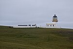
| Fair Isle, Aerogenerator
|
|
|
|
59°31′17″N 1°38′28″W / 59.521271°N 1.64104°W / 59.521271; -1.64104 (Fair Isle, Aerogenerator)
|
Category B
|
44538
|
 Upload another image
|
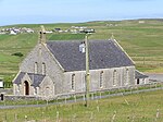
| Mail Kirk And Manse
|
|
|
|
60°02′04″N 1°13′50″W / 60.034317°N 1.230613°W / 60.034317; -1.230613 (Mail Kirk And Manse)
|
Category C(S)
|
44544
|

Upload Photo
|
| Bremire Crofthouse, Including Barns, Byre, Kiln, And Yard Wall
|
|
|
|
59°56′16″N 1°18′25″W / 59.937862°N 1.30704°W / 59.937862; -1.30704 (Bremire Crofthouse, Including Barns, Byre, Kiln, And Yard Wall)
|
Category C(S)
|
5415
|

Upload Photo
|
| Fair Isle, Fair Isle Old Hall (Now Museum)
|
|
|
|
59°31′03″N 1°38′34″W / 59.51754°N 1.642847°W / 59.51754; -1.642847 (Fair Isle, Fair Isle Old Hall (Now Museum))
|
Category B
|
5418
|

Upload Photo
|
| Troswick Clack Mills, Including Road Bridge And Footbridges
|
|
|
|
59°56′14″N 1°16′28″W / 59.937264°N 1.274448°W / 59.937264; -1.274448 (Troswick Clack Mills, Including Road Bridge And Footbridges)
|
Category B
|
5440
|

Upload Photo
|
| Sumburgh Head, Sumburgh Lighthouse, Including Ancillary Buildings, Fog Horn House, Sundial, Boundary And Retaining Walls, Gates And Gatepiers
|
|
|
|
59°51′16″N 1°16′27″W / 59.854508°N 1.274215°W / 59.854508; -1.274215 (Sumburgh Head, Sumburgh Lighthouse, Including Ancillary Buildings, Fog Horn House, Sundial, Boundary And Retaining Walls, Gates And Gatepiers)
|
Category A
|
5442
|
 Upload another image
See more images
|
| Fair Isle, Head Of Tind, South Fair Isle Lighthouse, Including Outbuilding, Sundial, Former Toilets And Petrol Store, Fog Horn House, Boundary Walls And Gatepiers, Former Lifeboat House, Winch, And Semaphore
|
|
|
|
59°30′50″N 1°39′08″W / 59.513947°N 1.65225°W / 59.513947; -1.65225 (Fair Isle, Head Of Tind, South Fair Isle Lighthouse, Including Outbuilding, Sundial, Former Toilets And Petrol Store, Fog Horn House, Boundary Walls And Gatepiers, Former Lifeboat House, Winch, And Semaphore)
|
Category B
|
5411
|
 Upload another image
See more images
|
| Southvoe, Shetland Crofthouse Museum Including Byre, Barn And Kiln, Boat-Roofed Shed, Kailyard And Boundary Walls
|
|
|
|
59°54′53″N 1°17′21″W / 59.914707°N 1.289193°W / 59.914707; -1.289193 (Southvoe, Shetland Crofthouse Museum Including Byre, Barn And Kiln, Boat-Roofed Shed, Kailyard And Boundary Walls)
|
Category B
|
5413
|
 Upload another image
|
| Sandsair Pier
|
|
|
|
60°00′25″N 1°13′14″W / 60.006808°N 1.220492°W / 60.006808; -1.220492 (Sandsair Pier)
|
Category B
|
49410
|

Upload Photo
|
| Fair Isle, Fair Isle Methodist Chapel, Including Boundary Wall And Gatepiers
|
|
|
|
59°31′03″N 1°38′32″W / 59.517367°N 1.642107°W / 59.517367; -1.642107 (Fair Isle, Fair Isle Methodist Chapel, Including Boundary Wall And Gatepiers)
|
Category C(S)
|
44540
|
 Upload another image
|
| Sumburgh House (Now Hotel), Including Terrace, Boundary Walls, And Gatepiers
|
|
|
|
59°52′10″N 1°17′14″W / 59.869306°N 1.287269°W / 59.869306; -1.287269 (Sumburgh House (Now Hotel), Including Terrace, Boundary Walls, And Gatepiers)
|
Category B
|
44548
|
 Upload another image
See more images
|
| Villains Crofthouse, Including Outbuildings
|
|
|
|
60°02′15″N 1°13′54″W / 60.037385°N 1.231583°W / 60.037385; -1.231583 (Villains Crofthouse, Including Outbuildings)
|
Category C(S)
|
44549
|

Upload Photo
|
| Sand Lodge, Including Walled Garden, Folly, Glasshouses, Conservatory, Steading And Cottage, Doocot, Sundial, Boundary Walls, Gates And Gatepiers
|
|
|
|
60°00′22″N 1°13′06″W / 60.006095°N 1.218447°W / 60.006095; -1.218447 (Sand Lodge, Including Walled Garden, Folly, Glasshouses, Conservatory, Steading And Cottage, Doocot, Sundial, Boundary Walls, Gates And Gatepiers)
|
Category B
|
5444
|
 Upload another image
See more images
|
| Fair Isle, North Fair Isle Lighthouse, Including Boundary Wall, Gate And Gatepiers, Sundial, Walkway And Fog Horn House
|
|
|
|
59°33′07″N 1°36′37″W / 59.55192°N 1.610201°W / 59.55192; -1.610201 (Fair Isle, North Fair Isle Lighthouse, Including Boundary Wall, Gate And Gatepiers, Sundial, Walkway And Fog Horn House)
|
Category B
|
5446
|
 Upload another image
See more images
|
| Fair Isle, Haa Of Fair Isle, Including Garage And Boundary Walls
|
|
|
|
59°30′58″N 1°38′34″W / 59.516175°N 1.642809°W / 59.516175; -1.642809 (Fair Isle, Haa Of Fair Isle, Including Garage And Boundary Walls)
|
Category B
|
5447
|
 Upload another image
|
| Sumburgh Home Farm, Including Farmhouse, Steading, Kiln And Boundary Walls
|
|
|
|
59°52′04″N 1°16′53″W / 59.867856°N 1.281514°W / 59.867856; -1.281514 (Sumburgh Home Farm, Including Farmhouse, Steading, Kiln And Boundary Walls)
|
Category B
|
5412
|

Upload Photo
|
| Fair Isle, Fair Isle Kirk (Church Of Scotland), Including Boundary Wall And Gatepiers
|
|
|
|
59°31′17″N 1°38′12″W / 59.521393°N 1.636727°W / 59.521393; -1.636727 (Fair Isle, Fair Isle Kirk (Church Of Scotland), Including Boundary Wall And Gatepiers)
|
Category C(S)
|
44539
|
 Upload another image
|
| Fair Isle, Shirva, Telephone Kiosk
|
|
|
|
59°31′18″N 1°38′37″W / 59.521601°N 1.643723°W / 59.521601; -1.643723 (Fair Isle, Shirva, Telephone Kiosk)
|
Category B
|
44542
|

Upload Photo
|
| Southvoe, Burn Of Wiltrow, Southvoe Water Mills, Including Footbridges
|
|
|
|
59°54′49″N 1°17′08″W / 59.913475°N 1.285482°W / 59.913475; -1.285482 (Southvoe, Burn Of Wiltrow, Southvoe Water Mills, Including Footbridges)
|
Category B
|
5414
|

Upload Photo
|
| Brew, Dunrossness Kirk (Church Of Scotland), Including Kirkyard Wall And Gatepiers
|
|
|
|
59°55′12″N 1°18′07″W / 59.919912°N 1.302013°W / 59.919912; -1.302013 (Brew, Dunrossness Kirk (Church Of Scotland), Including Kirkyard Wall And Gatepiers)
|
Category B
|
5439
|

Upload Photo
|
| Sandwick Church (Church Of Scotland), Including Railings, Walls And Gatepiers
|
|
|
|
59°59′48″N 1°13′33″W / 59.996702°N 1.225911°W / 59.996702; -1.225911 (Sandwick Church (Church Of Scotland), Including Railings, Walls And Gatepiers)
|
Category B
|
78
|
 Upload another image
|
| Fair Isle, North Haven, Storehouse
|
|
|
|
59°32′14″N 1°36′25″W / 59.537345°N 1.606868°W / 59.537345; -1.606868 (Fair Isle, North Haven, Storehouse)
|
Category C(S)
|
44541
|
 Upload another image
|
| Sandwick Manse, Including Outbuildings, Boundary And Garden Walls And Summerhouse
|
|
|
|
59°59′58″N 1°13′51″W / 59.999317°N 1.230816°W / 59.999317; -1.230816 (Sandwick Manse, Including Outbuildings, Boundary And Garden Walls And Summerhouse)
|
Category B
|
5443
|

Upload Photo
|
| Grutness, Lighthouse Store, Including Boundary Wall, Gate, And Gatepiers
|
|
|
|
59°52′22″N 1°16′44″W / 59.872781°N 1.278979°W / 59.872781; -1.278979 (Grutness, Lighthouse Store, Including Boundary Wall, Gate, And Gatepiers)
|
Category C(S)
|
44543
|

Upload Photo
|
| Out Voe, Fish-Curing Station
|
|
|
|
59°55′20″N 1°17′19″W / 59.922346°N 1.288564°W / 59.922346; -1.288564 (Out Voe, Fish-Curing Station)
|
Category B
|
44545
|
 Upload another image
|
| Quendale Haa, Including Boundary Wall, And Gateway
|
|
|
|
59°54′06″N 1°20′18″W / 59.901665°N 1.338396°W / 59.901665; -1.338396 (Quendale Haa, Including Boundary Wall, And Gateway)
|
Category B
|
44546
|
 Upload another image
|
| Bigton, Bigton House, Including Walls And Gatepiers
|
|
|
|
59°58′18″N 1°19′32″W / 59.971755°N 1.325446°W / 59.971755; -1.325446 (Bigton, Bigton House, Including Walls And Gatepiers)
|
Category B
|
5416
|

Upload Photo
|
| Quendale Mill, Including Dam, Steading, Walls, And Bridge
|
|
|
|
59°54′09″N 1°20′19″W / 59.902402°N 1.338525°W / 59.902402; -1.338525 (Quendale Mill, Including Dam, Steading, Walls, And Bridge)
|
Category A
|
5417
|
 Upload another image
See more images
|
| Bigton, St Ninian's Church (Church Of Scotland), Including Boundary Wall And Gatepiers
|
|
|
|
59°58′29″N 1°18′47″W / 59.974853°N 1.313183°W / 59.974853; -1.313183 (Bigton, St Ninian's Church (Church Of Scotland), Including Boundary Wall And Gatepiers)
|
Category C(S)
|
44537
|
 Upload another image
|


