| Name
|
Location
|
Date Listed
|
Grid Ref.
|
Geo-coordinates
|
Notes
|
LB Number
|
Image
|
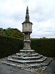
| Newbattle Abbey Policies, South Sundial
|
|
|
|
55°52′58″N 3°03′56″W / 55.882699°N 3.065641°W / 55.882699; -3.065641 (Newbattle Abbey Policies, South Sundial)
|
Category A
|
14563
|
 Upload another image
|
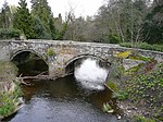
| Newbattle Abbey Policies, Maiden Bridge
|
|
|
|
55°53′16″N 3°03′43″W / 55.887861°N 3.061977°W / 55.887861; -3.061977 (Newbattle Abbey Policies, Maiden Bridge)
|
Category S
|
14564
|

Upload Photo
|
| Gorebridge, 70, 72, 74, Hunterfield Road, Newbyres Row
|
|
|
|
55°50′42″N 3°03′02″W / 55.8451°N 3.05043°W / 55.8451; -3.05043 (Gorebridge, 70, 72, 74, Hunterfield Road, Newbyres Row)
|
Category C(S)
|
46964
|

Upload Photo
|
| Newbattle, Newbattle Road, Newbattle Graveyard Including Boundary Walls
|
|
|
|
55°53′04″N 3°04′16″W / 55.884457°N 3.071125°W / 55.884457; -3.071125 (Newbattle, Newbattle Road, Newbattle Graveyard Including Boundary Walls)
|
Category B
|
46970
|

Upload Photo
|
| Newtongrange, Main Street, Newtongrange Parish Church (Church Of Scotland) Including Church Hall And Boundary Wall
|
|
|
|
55°51′59″N 3°03′58″W / 55.866486°N 3.065996°W / 55.866486; -3.065996 (Newtongrange, Main Street, Newtongrange Parish Church (Church Of Scotland) Including Church Hall And Boundary Wall)
|
Category C(S)
|
46972
|
 Upload another image
|
| Newbattle, Newbattle Road, Lamb's Nursery, Former Newbattle Abbey Walled Garden
|
|
|
|
55°53′08″N 3°04′15″W / 55.88562°N 3.070757°W / 55.88562; -3.070757 (Newbattle, Newbattle Road, Lamb's Nursery, Former Newbattle Abbey Walled Garden)
|
Category B
|
19485
|

Upload Photo
|
| Newbattle, Newbattle Road, Newbattle Abbey Gardens, Archbishop Leighton's House
|
|
|
|
55°53′03″N 3°04′09″W / 55.884276°N 3.069201°W / 55.884276; -3.069201 (Newbattle, Newbattle Road, Newbattle Abbey Gardens, Archbishop Leighton's House)
|
Category B
|
14543
|

Upload Photo
|
| Newtongrange, 1 - 12 (Inclusive Numbers) Lingerwood Cottages Including Boundary Wall
|
|
|
|
55°51′42″N 3°03′53″W / 55.861601°N 3.064648°W / 55.861601; -3.064648 (Newtongrange, 1 - 12 (Inclusive Numbers) Lingerwood Cottages Including Boundary Wall)
|
Category C(S)
|
14602
|

Upload Photo
|
| Gorebridge, Hunterfield Road, Gorebridge Parish Church (Church Of Scotland) Including Church Hall And Boundary Wall
|
|
|
|
55°50′46″N 3°03′03″W / 55.846219°N 3.050907°W / 55.846219; -3.050907 (Gorebridge, Hunterfield Road, Gorebridge Parish Church (Church Of Scotland) Including Church Hall And Boundary Wall)
|
Category C(S)
|
46965
|
 Upload another image
|
| Newbattle Road And Abbey Road, Gatepiers And Quadrant Walls
|
|
|
|
55°53′12″N 3°04′28″W / 55.886576°N 3.074445°W / 55.886576; -3.074445 (Newbattle Road And Abbey Road, Gatepiers And Quadrant Walls)
|
Category C(S)
|
46969
|

Upload Photo
|
| Newbattle Abbey Policies, Fernery
|
|
|
|
55°53′05″N 3°04′11″W / 55.884686°N 3.069644°W / 55.884686; -3.069644 (Newbattle Abbey Policies, Fernery)
|
Category B
|
19257
|

Upload Photo
|
| Newbattle, Newbattle Road, Newbattle Parish Church (Church Of Scotland)
|
|
|
|
55°52′59″N 3°04′15″W / 55.883104°N 3.070752°W / 55.883104; -3.070752 (Newbattle, Newbattle Road, Newbattle Parish Church (Church Of Scotland))
|
Category B
|
14558
|
 Upload another image
|
| Newbattle, Newbattle Road, Old Bridge
|
|
|
|
55°52′48″N 3°04′13″W / 55.879901°N 3.070216°W / 55.879901; -3.070216 (Newbattle, Newbattle Road, Old Bridge)
|
Category A
|
14568
|
 Upload another image
|
| Newbattle, Newbattle Road, 1 - 5 (Inclusive Numbers) Riverside Cottages
|
|
|
|
55°52′50″N 3°04′14″W / 55.880653°N 3.070525°W / 55.880653; -3.070525 (Newbattle, Newbattle Road, 1 - 5 (Inclusive Numbers) Riverside Cottages)
|
Category B
|
14569
|

Upload Photo
|
| Blinkbonny Farmhouse And Steading, Including Chimneystack
|
|
|
|
55°51′11″N 3°01′18″W / 55.85314°N 3.021782°W / 55.85314; -3.021782 (Blinkbonny Farmhouse And Steading, Including Chimneystack)
|
Category C(S)
|
46960
|

Upload Photo
|
| Southside Including Boundary Wall
|
|
|
|
55°51′49″N 3°00′33″W / 55.863685°N 3.009277°W / 55.863685; -3.009277 (Southside Including Boundary Wall)
|
Category B
|
14546
|

Upload Photo
|
| Newtongrange, 37 - 42 (Inclusive Numbers) Main Street, Monkwood
|
|
|
|
55°52′02″N 3°04′00″W / 55.867199°N 3.066671°W / 55.867199; -3.066671 (Newtongrange, 37 - 42 (Inclusive Numbers) Main Street, Monkwood)
|
Category C(S)
|
14601
|

Upload Photo
|
| Newtongrange, Lady Victoria Colliery, Manager's Office
|
|
|
|
55°51′43″N 3°03′54″W / 55.861949°N 3.064865°W / 55.861949; -3.064865 (Newtongrange, Lady Victoria Colliery, Manager's Office)
|
Category B
|
14603
|

Upload Photo
|
| Fordel Mains Farmhouse Including Walled Garden
|
|
|
|
55°53′21″N 2°59′51″W / 55.889075°N 2.997497°W / 55.889075; -2.997497 (Fordel Mains Farmhouse Including Walled Garden)
|
Category C(S)
|
46962
|

Upload Photo
|
| Fordel Park, Walled Garden
|
|
|
|
55°53′43″N 2°59′09″W / 55.895251°N 2.985854°W / 55.895251; -2.985854 (Fordel Park, Walled Garden)
|
Category C(S)
|
46963
|

Upload Photo
|
| Newtongrange, Main Street, The Dean Tavern
|
|
|
|
55°52′08″N 3°04′08″W / 55.868896°N 3.068907°W / 55.868896; -3.068907 (Newtongrange, Main Street, The Dean Tavern)
|
Category C(S)
|
46971
|

Upload Photo
|
| Lothianbridge, Newbattle Viaduct
|
|
|
|
55°52′19″N 3°04′38″W / 55.872041°N 3.077176°W / 55.872041; -3.077176 (Lothianbridge, Newbattle Viaduct)
|
Category B
|
14544
|

Upload Photo
|
| Lothianbridge, The Sun Inn
|
|
|
|
55°52′22″N 3°04′41″W / 55.872831°N 3.078188°W / 55.872831; -3.078188 (Lothianbridge, The Sun Inn)
|
Category C(S)
|
14545
|

Upload Photo
|
| Newbattle Abbey Policies, Grotto And Ice-House
|
|
|
|
55°52′54″N 3°04′03″W / 55.881578°N 3.067449°W / 55.881578; -3.067449 (Newbattle Abbey Policies, Grotto And Ice-House)
|
Category B
|
14565
|

Upload Photo
|
| Fordel Dean, Including Ancillary Buildings And Boundary Wall
|
|
|
|
55°53′17″N 2°59′04″W / 55.888145°N 2.98457°W / 55.888145; -2.98457 (Fordel Dean, Including Ancillary Buildings And Boundary Wall)
|
Category C(S)
|
46961
|

Upload Photo
|
| Newbattle, Newbattle Road, Newbattle House Including Boundary Wall
|
|
|
|
55°52′58″N 3°04′15″W / 55.882896°N 3.070842°W / 55.882896; -3.070842 (Newbattle, Newbattle Road, Newbattle House Including Boundary Wall)
|
Category B
|
14559
|

Upload Photo
|
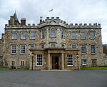
| Newbattle, Newbattle Abbey
|
|
|
|
55°52′58″N 3°04′01″W / 55.882705°N 3.067016°W / 55.882705; -3.067016 (Newbattle, Newbattle Abbey)
|
Category A
|
14561
|
 Upload another image
|
| Newbattle Abbey Policies, Newbattle Road, Monkland Wall
|
|
|
|
55°52′52″N 3°04′15″W / 55.881037°N 3.070727°W / 55.881037; -3.070727 (Newbattle Abbey Policies, Newbattle Road, Monkland Wall)
|
Category A
|
14566
|

Upload Photo
|
| Newbattle Abbey Policies, Port Lodge Including Quadrant Colonnades And Gatepiers
|
|
|
|
55°52′53″N 3°04′15″W / 55.881415°N 3.070721°W / 55.881415; -3.070721 (Newbattle Abbey Policies, Port Lodge Including Quadrant Colonnades And Gatepiers)
|
Category A
|
14567
|
 Upload another image
|
| Easthouses Colliery, Airshaft East Of Kippilaw
|
|
|
|
55°53′10″N 3°02′30″W / 55.886166°N 3.041611°W / 55.886166; -3.041611 (Easthouses Colliery, Airshaft East Of Kippilaw)
|
Category C(S)
|
49651
|

Upload Photo
|
| Newbattle, 20 Newbattle Road, The Old Sun Inn
|
|
|
|
55°52′54″N 3°04′17″W / 55.881554°N 3.071285°W / 55.881554; -3.071285 (Newbattle, 20 Newbattle Road, The Old Sun Inn)
|
Category B
|
14560
|

Upload Photo
|
| Newbattle Abbey Policies, North Sundial
|
|
|
|
55°53′00″N 3°03′58″W / 55.883278°N 3.066169°W / 55.883278; -3.066169 (Newbattle Abbey Policies, North Sundial)
|
Category A
|
14562
|
 Upload another image
|
| Lothianbridge, Craigesk House Including Boundary Wall And Entrance Gates
|
|
|
|
55°52′18″N 3°04′44″W / 55.871604°N 3.07881°W / 55.871604; -3.07881 (Lothianbridge, Craigesk House Including Boundary Wall And Entrance Gates)
|
Category C(S)
|
46966
|

Upload Photo
|
| Newbattle Abbey Policies, Lothian Burial Ground
|
|
|
|
55°53′02″N 3°04′09″W / 55.883828°N 3.069093°W / 55.883828; -3.069093 (Newbattle Abbey Policies, Lothian Burial Ground)
|
Category C(S)
|
46967
|

Upload Photo
|


