Map all coordinates using OpenStreetMap
Download coordinates as:
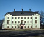
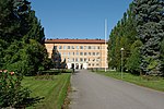
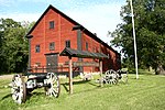
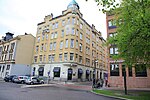
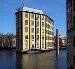
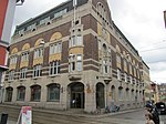
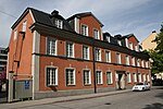
There are 132 listed buildings (Swedish: byggnadsminne) in Östergötland County.
Boxholm Municipality
| Image | Name | Premise | Number of buildings |
Year built | Architect | Coordinates | ID |
|---|---|---|---|---|---|---|---|
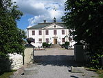
| Liljeholmens herrgård | Liljeholmen 1:5 | 3 | 58°02′14″N 15°03′48″E / 58.03711°N 15.06331°E / 58.03711; 15.06331 | 21300000014600 | |||
| Stjärnesands gård | Stjärnesand 1:2 | 2 | 58°04′24″N 15°12′12″E / 58.07341°N 15.20334°E / 58.07341; 15.20334 | 21300000014654 | |||
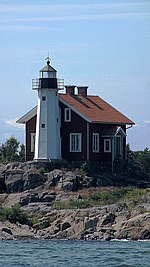
| Björnön | Ramfall 1:12 previously Ugglebo 1:1 |
3 | 58°04′02″N 15°15′09″E / 58.06727°N 15.25253°E / 58.06727; 15.25253 | 21300000015676 |
Finspång Municipality
| Image | Name | Premise | Number of buildings |
Year built | Architect | Coordinates | ID |
|---|---|---|---|---|---|---|---|

|
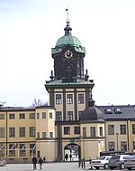
Finspångs slott | Norrmalm 1:4 Östermalm 1:6 |
8 | 58°42′34″N 15°46′23″E / 58.70943°N 15.77301°E / 58.70943; 15.77301 | 21300000015569 | ||
|
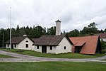
Häfla hammarsmedja | Hävla 3:2 | 15 | 58°54′01″N 15°49′29″E / 58.90018°N 15.82478°E / 58.90018; 15.82478 | 21300000014872 | ||
|
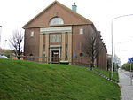
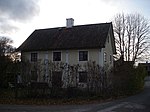
Renströmska skolan | Regna 3:12 | 1 | 58°53′34″N 15°41′39″E / 58.89267°N 15.69415°E / 58.89267; 15.69415 | 21300000014842 | ||
| Risinge gamla prästgård | Risinge 1:48 previously 1:7 |
3 | 58°40′31″N 15°50′33″E / 58.67530°N 15.84263°E / 58.67530; 15.84263 | 21300000015562 | |||
| Selesjö herrgård | Selesjö 1:6 | 5 | 58°52′15″N 15°57′56″E / 58.87095°N 15.96567°E / 58.87095; 15.96567 | 21300000014877 | |||
| Sonstorps herrgård | Sonstorp 3:1 | 5 | 58°44′30″N 15°37′32″E / 58.74154°N 15.62548°E / 58.74154; 15.62548 | 21300000015561 | |||
| Lugnet | Östermalm 1:8 | 2 | 58°42′16″N 15°47′09″E / 58.70435°N 15.78579°E / 58.70435; 15.78579 | 21000001750201 |
Kinda Municipality
| Image | Name | Premise | Number of buildings |
Year built | Architect | Coordinates | ID |
|---|---|---|---|---|---|---|---|
| Kölefors vaddfabrik | Torp 1:9 | 4 | 58°02′10″N 15°39′37″E / 58.03616°N 15.66021°E / 58.03616; 15.66021 | 21320000019106 | |||
| Ramshults loftbod | Ramshult 1:1 | 2 | 57°54′58″N 15°38′43″E / 57.91610°N 15.64531°E / 57.91610; 15.64531 | 21300000014632 |
Linköping Municipality
- Hemslöjdshuset, Linköping
- Rhyzeliusgårdens medeltidshus
Mjölby Municipality
Motala Municipality
Norrköping Municipality
Söderköping Municipality
Vadstena Municipality
Valdemarsvik Municipality
| Image | Name | Premise | Number of buildings |
Year built | Architect | Coordinates | ID |
|---|---|---|---|---|---|---|---|
| Villa Albacken | Valdemarsvik 4:60 | 1 | 58°12′07″N 16°36′44″E / 58.20200°N 16.61211°E / 58.20200; 16.61211 | 21000001535483 | |||
| Breviksnäs herrgård | Breviksnäs 3:8 | 5 | 58°07′57″N 16°48′22″E / 58.13240°N 16.80623°E / 58.13240; 16.80623 | 21300000014603 | |||

|
Fågelviks herrgård | Fågelvik 1:1, 1:2 | 8 | 58°07′23″N 16°42′11″E / 58.12293°N 16.70301°E / 58.12293; 16.70301 | 21300000014957 | ||
| Gräslundska släktgården | Gräsmarö 1:2 | 10 | 58°16′23″N 16°58′33″E / 58.27307°N 16.97597°E / 58.27307; 16.97597 | 21000001769901 | |||
| Kättilö tullhus | Barösund 1:1 | 2 | 58°11′42″N 16°53′51″E / 58.19493°N 16.89739°E / 58.19493; 16.89739 | 21300000014604 |
Ydre Municipality
| Image | Name | Premise | Number of buildings |
Year built | Architect | Coordinates | ID |
|---|---|---|---|---|---|---|---|
| Råås kvarn | Torpa-Rås 1:3 | 4 | 57°55′51″N 15°07′32″E / 57.93082°N 15.12546°E / 57.93082; 15.12546 | 21300000014935 | |||
|
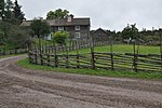
Smedstorps by or dubbelgård | Vi-Smedstorp 1:5 previously 1:3 |
18 | 57°56′37″N 15°24′51″E / 57.94362°N 15.41419°E / 57.94362; 15.41419 | 21300000015660 |
Åtvidaberg Municipality
| Image | Name | Premise | Number of buildings |
Year built | Architect | Coordinates | ID |
|---|---|---|---|---|---|---|---|
| Salvedals gamla skjutshåll | Borkhult 2:79 | 4 | 58°16′54″N 16°09′05″E / 58.28179°N 16.15139°E / 58.28179; 16.15139 | 21000001538480 | |||
| Bortgården i Falerum | Falerum 1:2 | 11 | 58°08′42″N 16°12′59″E / 58.14487°N 16.21636°E / 58.14487; 16.21636 | 21300000014605 | |||
| Grävsätters kuskbostad | Grävsätter 2:38 | 1 | 58°09′18″N 16°18′35″E / 58.15487°N 16.30984°E / 58.15487; 16.30984 | 21300000014606 | |||
| Herrsäters majorsboställe | Herrsätter 1:1 | 3 | 58°17′27″N 15°58′32″E / 58.29088°N 15.97561°E / 58.29088; 15.97561 | 21300000014987 | |||
| Ålundamagasinet | Mellersta Ålunda 5 | 1 | 58°11′52″N 16°00′06″E / 58.19769°N 16.00178°E / 58.19769; 16.00178 | 21300000027692 |
Ödeshög Municipality
| Image | Name | Premise | Number of buildings |
Year built | Architect | Coordinates | ID |
|---|---|---|---|---|---|---|---|
| Stora Broby väderkvarn | Ödeshög Broby 1:13 | 1 | 58°17′51″N 14°40′49″E / 58.29757°N 14.68040°E / 58.29757; 14.68040 | 21000001484460 | |||

|
Ellen Keys Strand | Ombergs Kronopark 1:2 | 2 | 58°17′40″N 14°38′22″E / 58.29450°N 14.63954°E / 58.29450; 14.63954 | 21300000015001 |
External links
- (in Swedish) Bebyggelseregistret

