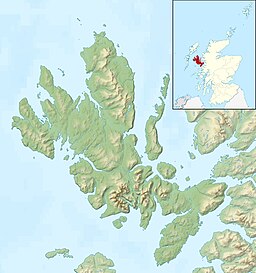
Sea Loch in Hebrides, Scotland
| Loch Snizort | |
|---|---|
 | |
 | |
| Location | Isle of Skye, Hebrides, Scotland |
| Coordinates | 57°34′N 6°28′W / 57.567°N 6.467°W / 57.567; -6.467 |
| Type | Sea Loch |
| Primary inflows | River Snizort |
| Primary outflows | The Lower Minch |
| Max. width | 8 miles (13 km) |
| Islands | Ascrib Islands |
| Settlements | Bernisdale |
| References | Groome, Francis H (1885). Ordnance Gazetteer of Scotland: A Survey of Scottish Topography. Vol. 6. Thomas C. Jack, Grange Publishing Works. Retrieved 8 October 2010. |
Loch Snizort (Scottish Gaelic: Loch Snìosort) is a sea loch in the northwest of the Isle of Skye between the Waternish and Trotternish peninsulas. It is fed by the River Snizort, originating in the hills east of Bracadale. The mouth of Loch Snizort gives access to the lower Minch and contains the Ascrib Islands.
Sea fishing in Loch Snizort yields mackerel, pollock, and ling.
See also
Footnotes
- "Loch Snizort". Gazetteer for Scotland. Retrieved 19 September 2009.
- Bradshaw, Mathew (2007). "Highland Fishing". Archived from the original on 11 January 2012. Retrieved 4 July 2011.
External links
 Media related to Loch Snizort at Wikimedia Commons
57°34′N 6°28′W / 57.567°N 6.467°W / 57.567; -6.467
This Highland location article is a stub. You can help Misplaced Pages by expanding it. |