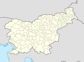
| Logar Valley Landscape Park | |
|---|---|
| Krajinski park Logarska dolina | |
| IUCN category V (protected landscape/seascape) | |
 Logar Valley Logar Valley | |
 | |
| Location | Slovenia |
| Coordinates | 46°23′1.03″N 14°37′17.92″E / 46.3836194°N 14.6216444°E / 46.3836194; 14.6216444 |
| Area | 24.75 km (9.56 sq mi) |
| Established | 1987 |

The Logar Valley (Slovene: Logarska dolina, Logarjeva dolina) is a valley in the Kamnik Alps, in the Municipality of Solčava, Slovenia. The Slovene name for the valley is of relatively recent coinage and is derived from the Logar Farm, which in turn is derived from log (literally, 'swampy meadow'). In 1987, the valley received protected status as a landscape park encompassing 24.75 square kilometres (9.56 sq mi).
Geography
The Logar Valley is a typical U-shaped glacial valley. It is divided into three parts. The lower part is named Log, the middle part Plest or Plestje (it is a mostly wooded area), and the upper part Kot (literally 'cirque') or Ogradec (it is a wooded area with scree slopes). Altogether 35 people live on the isolated farmsteads in the valley.
Peaks

The Logar Valley is ringed by the following peaks: Strelovec (1,763 m or 5,784 ft), Krofička (2,083 m or 6,834 ft), Ojstrica (2,350 m or 7,710 ft), Lučka Baba (2,244 m or 7,362 ft), Planjava (2,394 m or 7,854 ft), Brana (2,252 m or 7,388 ft), Turska Gora (2,251 m or 7,385 ft), and Mrzla Gora (2,203 m or 7,228 ft). It terminates in a head wall beneath the Okrešelj Cirque, where the Savinja River starts at an ice-cold spring at an elevation of 1,280 meters and flows to Rinka Falls.
Climate
Although the Logar Valley is not particularly narrow (about 500 m at its narrowest), inversions are very common due to the influence of a northern anticyclone. Temperature distributions on the slopes are greatly influenced by differences between the sunny and shady areas, which is seen in different snow and ice conditions in the winter.
A walking path (2–3 hours) through the valley leads past a number of points of interest: the source of Black Creek (Črna), wooden logging chutes, a burl-covered ash tree, a charcoal-maker’s hut, and other sights.
References
- "Predstavitev Krajinskega parka Logarska dolina". Retrieved 5 May 2013.
- "Data on ProtectedPlanet.net". World Database on Protected Areas (WDPA). Retrieved 5 May 2013.
- ^ Mišič, Franc. 1938. "O ledinskih in hišnih imenih okoli Solčave." Časopis za zgodovino in narodopisje 33(3/4): 191–201, p. 197.
- Hrvatin, Mauro. "Logarska dolina" [Logar Valley]. In Šmid Hribar, Mateja; Golež, Gregor; Podjed, Dan; Kladnik, Drago; Erhartič, Bojan; Pavlin, Primož; Ines, Jerele (eds.). Enciklopedija naravne in kulturne dediščine na Slovenskem – DEDI (in Slovenian). Retrieved 19 February 2013.
External links
 Media related to Logar Valley (Slovenia) at Wikimedia Commons
- Upper Savinja Valley: tourism in the Logar Valley and surroundings
| Hydrography of Slovenia | ||
|---|---|---|
| Rivers |
|  |
| Streams | ||
| Waterfalls | ||
| Lakes | ||
| Wetlands | ||
| Sea | ||
| River valleys | ||
| Canyons and gorges | ||
| Municipality of Solčava | ||||||
|---|---|---|---|---|---|---|
| Settlements | Administrative seat: Solčava
|  | ||||
| Landmarks | ||||||