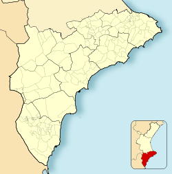
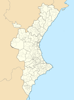
| Lorcha L'Orxa | |
|---|---|
| Municipality | |
 Sant Vicent Street within Lorcha (L'Orxa) Sant Vicent Street within Lorcha (L'Orxa) | |
 Flag Flag Coat of arms Coat of arms | |
   | |
| Coordinates: 38°50′37″N 00°18′43″W / 38.84361°N 0.31194°W / 38.84361; -0.31194 | |
| Country | |
| Autonomous community | |
| Province | Alicante |
| Comarca | Comtat |
| Judicial district | Alcoy |
| Government | |
| • Alcalde | Arnaldo Dueñas Crespo (2015) |
| Area | |
| • Total | 31.80 km (12.28 sq mi) |
| Elevation | 467 m (1,532 ft) |
| Population | |
| • Total | 581 |
| • Density | 18/km (47/sq mi) |
| Demonym(s) | Lorchano, -a |
| Time zone | UTC+1 (CET) |
| • Summer (DST) | UTC+2 (CEST) |
| Postal code | 03860 |
| Dialing code | 960-963 |
| Official language(s) | Valencian |
Lorcha (Spanish: [ˈloɾtʃa]), or L'Orxa (Valencian: [ˈloɾtʃa]), is a municipality in the comarca of Comtat in the Valencian Community, Spain. As of the year 2021, it has a total population of 581.
History
The settlement first appeared as Alquenènsia in a 1379 census. Following the Expulsion of the Moriscos in 1609, it was repopulated by migrants from Mallorca.
Geography
Lorcha is located along the northern edge of Alicante, to the east of Serpis River. Highway CV-701 passes through the northeastern portion of the municipality. Its average elevation is 467 meters above the sea level.
Climate
Lorcha has a Hot-summer Mediterranean Climate (Csa). It sees the least precipitation in July, with an average rainfall of 10 mm; and the most precipitation in September, with an average rainfall of 82 mm.
| Climate data for Lorcha | |||||||||||||
|---|---|---|---|---|---|---|---|---|---|---|---|---|---|
| Month | Jan | Feb | Mar | Apr | May | Jun | Jul | Aug | Sep | Oct | Nov | Dec | Year |
| Mean daily maximum °C (°F) | 12.7 (54.9) |
13.2 (55.8) |
16.1 (61.0) |
18.4 (65.1) |
21.9 (71.4) |
27.0 (80.6) |
29.9 (85.8) |
29.5 (85.1) |
25.2 (77.4) |
21.4 (70.5) |
15.7 (60.3) |
13.1 (55.6) |
20.3 (68.6) |
| Daily mean °C (°F) | 8.0 (46.4) |
8.5 (47.3) |
11.1 (52.0) |
13.6 (56.5) |
17.1 (62.8) |
21.8 (71.2) |
24.7 (76.5) |
24.4 (75.9) |
20.7 (69.3) |
17.0 (62.6) |
11.4 (52.5) |
8.7 (47.7) |
15.6 (60.1) |
| Mean daily minimum °C (°F) | 4.1 (39.4) |
4.3 (39.7) |
6.6 (43.9) |
8.9 (48.0) |
12.0 (53.6) |
16.4 (61.5) |
19.5 (67.1) |
19.8 (67.6) |
16.7 (62.1) |
13.2 (55.8) |
7.9 (46.2) |
5.1 (41.2) |
11.2 (52.2) |
| Average rainfall mm (inches) | 52 (2.0) |
44 (1.7) |
52 (2.0) |
62 (2.4) |
48 (1.9) |
22 (0.9) |
10 (0.4) |
27 (1.1) |
82 (3.2) |
77 (3.0) |
64 (2.5) |
58 (2.3) |
598 (23.4) |
| Source: Climate-Data.org | |||||||||||||
References
- "Lorcha (Alicante, Valencian Community, Spain) - Population Statistics, Charts, Map, Location, Weather and Web Information". www.citypopulation.de. Retrieved 2023-06-08.
- Labrado, Victor (2007). "L'haqueta, l'encantada i la viuda". A: Llegendes valencianes : criatures mítiques de la tradició oral. p. 133. ISBN 978-84-9824-156-3.
- "l'Orxa / Lorcha topographic map, elevation, terrain". Topographic maps. Retrieved 2023-06-08.
- "Lorcha climate: Temperature Lorcha & Weather By Month - Climate-Data.org". en.climate-data.org. Retrieved 2023-06-08.
This article about a location in the Valencian Community, Spain, is a stub. You can help Misplaced Pages by expanding it. |