| This article needs additional citations for verification. Please help improve this article by adding citations to reliable sources. Unsourced material may be challenged and removed. Find sources: "Lordship Lane, Southwark" – news · newspapers · books · scholar · JSTOR (August 2010) (Learn how and when to remove this message) |

Lordship Lane is an ancient thoroughfare, once rural, in East Dulwich, a suburb of the London Borough of Southwark in southeast London, England, and forms part of the A2216.
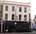
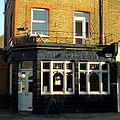
It runs north–south from Goose Green to Wood Vale. The Lordship Lane and North Cross Road area now has a wide selection of bars, restaurants and specialist retailers for the 'foodie' market.
Points of interest

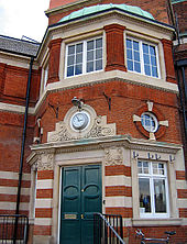
The architecturally meritorious Dulwich Library, which opened on 24 November 1897, is on the lane. Lordship Lane is also home of the unusual listed building, the so-called "Concrete House".
The children's author, Enid Blyton was born on 11 August 1897 above a shop in Lordship Lane. A Southwark Blue Plaque was placed there in 2003 (above 352–356 Lordship Lane, near the library).
The Concrete House

One of the most architecturally interesting buildings in the area is at 549 Lordship Lane. The so-called "Concrete House" grade II listed building and is an example of a 19th-century concrete house. It was built in 1873 by Charles Drake of the Patent Concrete Building Company. In 1867, the builder had patented the use of iron panels for shuttering rather than timber. It is listed on English Heritage's Buildings At Risk register. Southwark Council refused permission for its demolition.
Derelict for many years it has now been restored with the help of the Heritage of London Trust into 5 flats, to be managed by Hexagon Housing Association. The Duke of Gloucester opened the completed building on 13 June 2013.
History of the lane
Lordship Lane is East Dulwich's oldest street. It is an ancient thoroughfare that significantly predates the late 19th century developments. The area was transformed from fields and market gardens to Victorian suburbs in the period 1865–1885. The tram line that once served Lordship Lane is long gone.
Lordship Lane station
Main article: Lordship Lane railway station
Lordship Lane station was a station on the Crystal Palace and South London Junction Railway, built by the London, Chatham and Dover Railway in 1865, which closed along with the rest of the line on 20 September 1954. The railway crossed London Road (just beyond the southern end of Lordship Lane) on a bridge and the station was just to the south-west of the road. The site is now housing: the London Borough of Southwark's Sydenham Hill Estate.
This locality is also the subject of Lordship Lane Station, Dulwich, an 1871 painting by Camille Pissarro, which now hangs at the Courtauld Institute of Art in London.
Gallery of shops and sites
-
 East Dulwich Tavern, 1 Lordship Lane
-
 Chener Books, 14 Lordship Lane
-
 East Dulwich Deli, closed, 15–17 Lordship Lane
-
 Paine and Hunter Opticians, 55 Lordship Lane
-
Black Cherry (bar & restaurant, closed), 21 Lordship Lane
-
 The Bishop (pub & restaurant), 27 Lordship Lane
-
 Dulwich Cafe, 89 Lordship Lane
-
 Willam Rose Butchers, 126 Lordship Lane
-
 The Lane Cafe, closed, 135 Lordship Lane
-
 Franklins (bar & restaurant), 157 Lordship Lane
-
 Police Station, now a school, 173–183 Lordship Lane
-
 Baptist Church, 257 Lordship Lane
-
 Enid Blyton blue plaque, 352 Lordship Lane
See also
- Lordship Lane SE22 ordered by address Photographs ordered by address in Lordship Lane (Wikimedia Commons)
- Dulwich Library
References
External links
- Lordship Lane, East Dulwich
- History of the Lordship Lane area
- English Heritage on the Concrete House
- Lordship Lane website
- Lordship Lane Restaurants
- Dulwich Library
51°27′05″N 0°04′35″W / 51.4515°N 0.0765°W / 51.4515; -0.0765
Categories: