| Lubuklinggau | |
|---|---|
| City | |
| City of Lubuklinggau Kota Lubuklinggau | |
 Museum of the Lubuk Linggau army detachment Museum of the Lubuk Linggau army detachment | |
 Coat of arms Coat of arms | |
| Motto: Sebiduk Semare | |
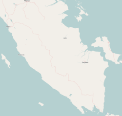
 Location within South Sumatra Location within South Sumatra | |
   | |
| Coordinates: 3°17′48″S 102°51′42″E / 3.29667°S 102.86167°E / -3.29667; 102.86167 | |
| Country | |
| Region | Sumatra |
| Province | |
| Founded | 21 June 2001 |
| Government | |
| • Mayor | Koimuddin (Pj Walikota) |
| • Vice Mayor | - |
| Area | |
| • Total | 401.50 km (155.02 sq mi) |
| Population | |
| • Total | 241,894 |
| • Density | 600/km (1,600/sq mi) |
| • Rank | 79 |
| Time zone | UTC+7 (Indonesia Western Time) |
| Area code | (+62) 733 |
| Website | lubuklinggaukota.go.id |
Lubuklinggau, is a city in South Sumatra, Indonesia. It has an area of 401.50 km and had a population of 201,308 at the 2010 Census and 234,166 at the 2020 Census; the official estimate as at mid 2023 was 241,894 (comprising 121,877 males and 120,017 females). The city was formerly part of the Musi Rawas Regency from which it was separated on 21 June 2001.
Geography
The city borders the Rejang Lebong Regency in Bengkulu to the south and west. It also borders the Musi Rawas Regency to the north and east.
Administrative Districts
The city is divided into eight districts (kecamatan), listed below with their areas and their populations at the 2010 and 2020 Censuses, together with the official estimates as at mid 2023. The table also includes the number of urban villages (all classed as kelurahan) in each district, and its post codes.
| Kode Wilayah |
Name of District (kecamatan) |
Area in km |
Pop'n Census 2010 |
Pop'n Census 2020 |
Pop'n Estimate mid 2023 |
No. of kelurahan |
Post code |
|---|---|---|---|---|---|---|---|
| 16.73.02 | Lubuklinggau Barat I | 54.81 | 30,377 | 38,340 | 40,000 | 11 | 31611 - 31615 |
| 16.73.06 | Lubuklinggau Barat II | 10.84 | 21,340 | 20,938 | 20,990 | 8 | 31611 - 31616 |
| 16.73.03 | Lubuklinggau Selatan I | 85.15 | 13,905 | 16,012 | 16,940 | 7 | 31629 |
| 16.73.07 | Lubuklinggau Selatan II | 37.26 | 26,447 | 33,242 | 34,500 | 9 | 31627 |
| 16.73.01 | Lubuklinggau Timur I | 13.90 | 30,685 | 34,290 | 34,920 | 8 | 31628 |
| 16.73.05 | Lubuklinggau Timur II | 10.12 | 30,935 | 33,023 | 32,820 | 9 | 31621 - 31624 |
| 16.73.04 | Lubuklinggau Utara I | 152.30 | 15,313 | 17,907 | 18,580 | 10 | 31618 - 31619 |
| 16.73.08 | Lubuklinggau Utara II | 37.11 | 32,306 | 40,414 | 43,160 | 10 | 31617, 31619, 31627, 31628 |
| Totals | 401.50 | 201,308 | 234,166 | 241,894 | 72 |
Transportation


Lubuklinggau is situated on the highway between Palembang and Bengkulu. There are many forms of public transportation in Lubuklinggau, such as becak and angkot. Lubuklinggau is served by Silampari Airport, which is located around 5 km from the town centre. The airport served several flights to Palembang and Jakarta. Railroad tracks connect Lubuklinggau with Palembang to the east. There are two daily train trips from the Lubuklinggau Station to Kertapati Station in Palembang and vice versa.
References
- ^ Badan Pusat Statistik, Jakarta, 28 February 2024, Kota Lubuklinggau Dalam Angka 2024 (Katalog-BPS 1102001.1674)
- ^ Biro Pusat Statistik, Jakarta, 2011.
- ^ Badan Pusat Statistik, Jakarta, 2021.
External links
- (in Indonesian) Official website
3°17′48″S 102°51′42″E / 3.29667°S 102.86167°E / -3.29667; 102.86167
| Regencies and cities of South Sumatra | ||
|---|---|---|
| Capital: Palembang | ||
| Regencies | ||
| Cities | ||
| 2,000,000 and above | |
|---|---|
| 1,000,000–1,999,999 | |
| 500,000–999,999 | |
| 300,000–499,999 | |
| 200,000–299,999 | |
| Note: Bold indicates provincial capital | |
This South Sumatra location article is a stub. You can help Misplaced Pages by expanding it. |