| This article includes a list of references, related reading, or external links, but its sources remain unclear because it lacks inline citations. Please help improve this article by introducing more precise citations. (March 2022) (Learn how and when to remove this message) |
| Lusagyugh Լուսագյուղ | |
|---|---|
 Panorama of Lusagyugh Panorama of Lusagyugh | |
  | |
| Coordinates: 40°36′31.50″N 44°22′55.89″E / 40.6087500°N 44.3821917°E / 40.6087500; 44.3821917 | |
| Country | Armenia |
| Province | Aragatsotn |
| Municipality | Aparan |
| Elevation | 1,950 m (6,400 ft) |
| Population | |
| • Total | 710 |
| Time zone | UTC+4 |
| • Summer (DST) | UTC+5 |
Lusagyugh (Armenian: Լուսագյուղ) is a village in the Aparan Municipality of the Aragatsotn Province of Armenia, located 1 km northeast of the town of Aparan.
The village is home to a church dating back to 1887 as well as the ruins of a 4th-century church.
- Lusagyugh
-
 Entrance to the village at the road from Aparan
-
 Lusagyugh and Aparan
-
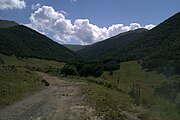
 Natural sight 4 km from the village
-
 Winter in Lusagyugh, Aparan
-
 Lusagyugh forest
-
 Tukh Manuk chapel, 7th century
References
- "Aragatsotn (Armenia): Towns and Villages in Municipalities". www.citypopulation.de. Retrieved 2024-11-11.
- Lusagyugh, Aragatsotn at GEOnet Names Server
- Report of the results of the 2001 Armenian Census, Statistical Committee of Armenia
This article about a location in Aragatsotn Province, Armenia is a stub. You can help Misplaced Pages by expanding it. |
