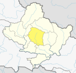
| Lwang Ghalel ल्वाङ घलेल | |
|---|---|
| Village Development Committee | |
  | |
| Coordinates: 28°27′N 83°55′E / 28.45°N 83.91°E / 28.45; 83.91 | |
| Country | |
| Zone | Gandaki Zone |
| District | Kaski District |
| Population | |
| • Total | 4,758 |
| Time zone | UTC+5:45 (Nepal Time) |
Lwangghale or Lwang-Ghalel is a town and Village Development Committee in Kaski District in the Gandaki Zone of northern-central Nepal. At the time of the 1991 Nepal census it had a population of 4,758 persons living in 973 individual households.
References
- "Maplandia".
- "Nepal Census 2001". Nepal's Village Development Committees. Digital Himalaya. Archived from the original on 12 October 2008. Retrieved 30 September 2008.
External links
| Kaski District | ||
|---|---|---|
| Headquarters: Pokhara | ||
| Metropolitan cities |  | |
| Rural municipalities | ||
| Former VDCs |
| |
| Villages | ||
This article about a location in the Kaski District of Nepal is a stub. You can help Misplaced Pages by expanding it. |