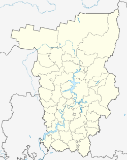
| Lyovino Лёвино | |
|---|---|
| Selo | |
  | |
| Coordinates: 57°37′N 54°49′E / 57.617°N 54.817°E / 57.617; 54.817 | |
| Country | Russia |
| Region | Perm Krai |
| District | Bolshesosnovsky District |
| Time zone | UTC+5:00 |
Lyovino (Russian: Лёвино) is a rural locality (a selo) and the administrative center of Levinskoye Rural Settlement, Bolshesosnovsky District, Perm Krai, Russia. The population was 321 as of 2010. There are 11 streets.
Geography
Lyovino is located 22 km east of Bolshaya Sosnova (the district's administrative centre) by road. Burdino is the nearest rural locality.
References
- Карта села Лёвино в Пермском крае
- "ВПН-2010. Численность и размещение населения Пермского края". Archived from the original on 2013-08-31. Retrieved 2019-03-29.
- Расстояние от Левино до Большой Сосновой
This Bolshesosnovsky District location article is a stub. You can help Misplaced Pages by expanding it. |