| Lyubets Любец | |
|---|---|
| Selo | |
  | |
| Coordinates: 56°19′N 41°12′E / 56.317°N 41.200°E / 56.317; 41.200 | |
| Country | Russia |
| Region | Vladimir Oblast |
| District | Kovrovsky District |
| Time zone | UTC+3:00 |
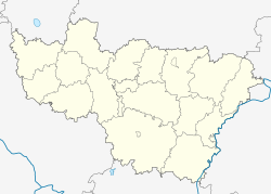
Lyubets (Russian: Любец) is a rural locality (a selo) in Novoselskoye Rural Settlement, Kovrovsky District, Vladimir Oblast, Russia. The population was 14 as of 2010.
Geography
Lyubets is located on the right bank of the Klyazma River, 11 km southwest of Kovrov (the district's administrative centre) by road. Pogost is the nearest rural locality.
References
- Село Любец на карте
- Всероссийская перепись населения 2010 года. Численность населения по населённым пунктам Владимирской области Archived 2014-07-21 at WebCite. Retrieved 2014-07-21.
- Расстояние от Любеца до Коврова
This Kovrovsky District location article is a stub. You can help Misplaced Pages by expanding it. |