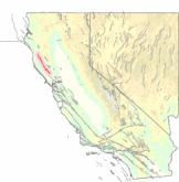
 Geologic maps of the Maacama Fault
The Maacama Fault is a right lateral-moving (dextral) geologic fault located in the Coast Ranges of northwestern California. It is considered to be the northernmost segment of the Hayward Fault subsystem of the San Andreas Fault zone. Creep along the Maacama is about 8 mm per year, consistent with the steady movement along the rest of the Hayward Fault system. It is also capable of producing large earthquakes.
The Maacama Fault runs just east of Ukiah and just west of Willits.
References
- Larsen, M.; Prentice, C. S.; Kelsey, H. M.; Zachariasen, J.; Rotberg, G. L. (2005). "Paleoseismic Investigation of the Maacama Fault at the Haehl Creek Site, Willits, California". gsa.confex.com. The Geological Society of America. Archived from the original on 2016-08-14. Retrieved 12 December 2008.
- Larsen, M.; Prentice, C. S.; Kelsey, H. M.; Zachariasen, J.; Rotberg, G. L. (April 2005). "Paleoseismic Investigation of the Maacama Fault at the Haehl Creek Site, Willits, California". Geological Society of America Abstracts with Programs. 37 (4): 68.
This geographical article related to Sonoma County, California is a stub. You can help Misplaced Pages by expanding it. |
This Mendocino County, California–related article is a stub. You can help Misplaced Pages by expanding it. |