| Mahisasan | |||||
|---|---|---|---|---|---|
| Indian Railways station | |||||
| General information | |||||
| Location | Mahisasan, Karimganj district, Assam India | ||||
| Coordinates | 24°49′30″N 92°17′28″E / 24.825°N 92.291°E / 24.825; 92.291 | ||||
| Construction | |||||
| Structure type | Standard (on ground station) | ||||
| Parking | opened = 1896-98 | ||||
| Other information | |||||
| Status | Functioning | ||||
| Station code | |||||
| Zone(s) | Northeast Frontier Railway | ||||
| History | |||||
| Previous names | Assam Bengal Railway | ||||
| |||||
| Karimganj–Kulaura line | ||||||||||||||||||||||||||||||||||||||||||||||||||||||||||||||||||||||||||||||||||||||||||||||||||
|---|---|---|---|---|---|---|---|---|---|---|---|---|---|---|---|---|---|---|---|---|---|---|---|---|---|---|---|---|---|---|---|---|---|---|---|---|---|---|---|---|---|---|---|---|---|---|---|---|---|---|---|---|---|---|---|---|---|---|---|---|---|---|---|---|---|---|---|---|---|---|---|---|---|---|---|---|---|---|---|---|---|---|---|---|---|---|---|---|---|---|---|---|---|---|---|---|---|---|
| ||||||||||||||||||||||||||||||||||||||||||||||||||||||||||||||||||||||||||||||||||||||||||||||||||
| Legend | ||||||||||||||||||||||||||||||||||||||||||||||||||||||||||||||||||||||||||||||||||||||||||||||||||
| ||||||||||||||||||||||||||||||||||||||||||||||||||||||||||||||||||||||||||||||||||||||||||||||||||
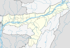
Mahisasan is a border railway station and a defunct railway transit facility point on the India–Bangladesh border in Karimganj district in the Indian state of Assam. The corresponding station on the Bangladesh side is Shahbajpur (also known as Latu) in Sylhet District. The border station is linked to Karimganj 11 kilometres (6.8 mi) away. The Mahisasan–Shahbajpur route has not been operational since December, 1996 due to lack of traffic.
History
In response to the demand of the Assam tea planters for a railway link to Chittagong port, Assam Bengal Railway started construction of a railway track on the eastern side of Bengal in 1891. A 150 kilometres (93 mi) track between Chittagong and Comilla was opened to traffic in 1895. The Comilla–Akhaura–Kulaura–Badarpur section was opened in 1896–1898 and finally extended to Lumding in 1903. Mahisasan was a station on this track. With the partition of India in 1947, it assumed importance as a border station.
Broad gauge
The Railway Budget for 2011–12 has approved the conversion of the metre-gauge Karimganj-Mahisasan section to broad gauge. Now this a broad-gauge single-track non-electrified line. Currently 2 passenger trains are running in this line from Silchar, Maishashan–Silchar Passenger
Metre gauge
Earlier it was functioning as a metre-gauge railway station, but after 2015, it was upgraded to BG.
Trans-Asian Railway
Currently, all freight traffic originating from Asia destined for Europe goes by sea. The Trans-Asian Railway will enable containers from Singapore, China, Vietnam, Cambodia, India, Bangladesh, Myanmar, Thailand and Korea to travel over land by train to Europe. The Southern Corridor of the Trans-Asian Railway is of prime interest to India. It connects Yunnan in China and Thailand with Europe via Turkey and passes through India.
There is a general understanding between India and Myanmar that their railways will be interconnected via a 346-km line section that will extend from Kalay in Myanmar to Jiribam in India via the border point at Tamu / Moreh.
The proposed route will enter India through Tamu and Moreh in Manipur bordering Myanmar, then enter Bangladesh through Mahisasan and Shahbajpur and again enter India from Bangladesh at Gede. On the western side, the line will enter Pakistan at Attari. There is a 315 kilometres (196 mi) missing link on this route in the India–Myanmar sector; of this, 180 kilometres (110 mi), in India, is between Jiribam in Manipur and Tamu in Myanmar. The rail link between Jiribam and Imphal has been sanctioned by Indian Railways, but that is unlikely to be completed before 2016. At present construction work is in progress in a 97 kilometres (60 mi) stretch between Jiribam and Tupul.
References
- "Rail Link with Bangladesh". Press Information Bureau, Government of India. 7 September 2007. Retrieved 22 December 2011.
- Fida, Quazi Abul (2012). "Railway". In Islam, Sirajul; Jamal, Ahmed A. (eds.). Banglapedia: National Encyclopedia of Bangladesh (Second ed.). Asiatic Society of Bangladesh.
- "Report on the administration of North East India (1921-22)". p. 46. Mittal Publishers Distributors. 1984. Retrieved 16 December 2011 – via Google Books.
- S.N. Singh; Amarendra Narain; Purnendu Kumar (January 2006). Socio Economic and Political Problems of Tea Garden Workers: A Study of Assam. New Delhi: Mittal Publications (published 2006). p. 105. ISBN 81-8324-098-4. Retrieved 16 December 2011.
- "Trans-Asian Railway". Streamline Supply Chain. Retrieved 22 December 2011.
- "Priority Investment Needs for the development of the Trans-Asian Railway Network" (PDF). Economic and Social Commission for Asia and the Pacific. Archived from the original (PDF) on 20 January 2012. Retrieved 26 December 2011.
- "Agreement on Trans-Asian railway passing through Manipur signed". Larkhawm. Retrieved 22 December 2011.
- "India signs accord on trans-Asian railway network". The Hindu. 1 July 2007. Archived from the original on 12 August 2007. Retrieved 22 December 2011.
- "B'desh segment of TAR route preparation shows progress". Financial Express. 18 March 2011. Retrieved 22 December 2011.
- "Manipur gets rail gift for Trinamul bypoll win – Tall promises of connecting all capitals of region leaves Northeast industry captains unimpressed". The Telegraph. 26 February 2011. Archived from the original on 1 March 2011. Retrieved 22 December 2011.
| Railway stations in Assam | |||||||||
|---|---|---|---|---|---|---|---|---|---|
| NEFRTooltip Northeast Frontier Railway zone |
| ||||||||

