Town in New South Wales, Australia
| Malebo New South Wales | |
|---|---|
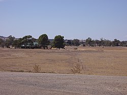
 Malebo Shooting Range Malebo Shooting Range | |
 | |
| Coordinates | 35°04′S 147°16′E / 35.067°S 147.267°E / -35.067; 147.267 |
| Postcode(s) | 2650 |
| Elevation | 169 m (554 ft) |
| Location |
|
| LGA(s) | City of Wagga Wagga |
| County | Bourke |
| State electorate(s) | Wagga Wagga |
Malebo is an unbounded neighbourhood in the locality of Euberta in the central east part of the Riverina. It is situated by road, about 10 km west of Wagga Wagga and 16 km east of Millwood.
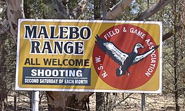
Malebo has no public buildings nor signage other than the prominent Malebo Shooting Range sign on the ridge of Malebo hill.
Malebo Post Office opened on 16 August 1888 and closed in 1912. It had a hotel.

References
- Premier Postal History, Post Office List, retrieved 11 June 2009
- "News". The Sydney Morning Herald. 12 May 1931. p. 10. Retrieved 6 September 2017.
The homestead was formerly known as Malebo Hotel, ...
This Riverina geography article is a stub. You can help Misplaced Pages by expanding it. |