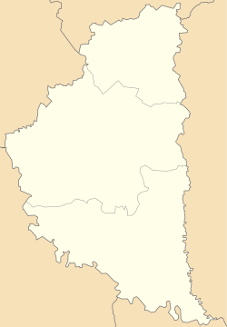
Village in Ternopil Oblast, Ukraine
| Mali Chornokintsi Малі Чорнокінці | |
|---|---|
| Village | |
 Church of the Holy First Martyr Tekli inside the village Church of the Holy First Martyr Tekli inside the village | |
  | |
| Coordinates: 48°58′26″N 25°59′47″E / 48.97389°N 25.99639°E / 48.97389; 25.99639 | |
| Country | |
| Oblast | |
| Raion | Chortkiv |
| Hromada | Kolyndiany |
| Area | |
| • Total | 2.17 km (0.84 sq mi) |
| Elevation | 282 m (925 ft) |
| Population | |
| • Total | 411 |
| • Density | 190/km (490/sq mi) |
| Time zone | UTC+2 (EET) |
| • Summer (DST) | UTC+3 (EEST) |
| Postal code | 48525 |
| Telephone code | +380 3552 |
Mali Chornokintsi (Ukrainian: Малі Чорнокінці, lit. 'Small black ends') is a village in Kolydinay rural hromada, Chortkiv Raion, Ternopil Oblast, Ukraine. As of 2018, the village has a population of 411.
The village used to be the administrative center of the Malochornokinets village council. In September 2015, it was transferred to the Kolydinay rural hromada.
Geography
Mali Chornokintsi is located on the banks of the Nichlava River, about 25 kilometres east of the Raion seat Chortkiv. The village has an average elevation of 282 metres (925 ft) above the sea level.
Climate
Mali Chornokintsi has a Humid Continental Climate (Dfb). It receives the most amount of rainfall in July, with an average precipitation of 100 mm; and the least rainfall in January, with an average precipitation of 36 mm.
| Climate data for Mali Chornokintsi | |||||||||||||
|---|---|---|---|---|---|---|---|---|---|---|---|---|---|
| Month | Jan | Feb | Mar | Apr | May | Jun | Jul | Aug | Sep | Oct | Nov | Dec | Year |
| Mean daily maximum °C (°F) | −0.9 (30.4) |
1.1 (34.0) |
6.9 (44.4) |
14.5 (58.1) |
20.0 (68.0) |
23.2 (73.8) |
25.0 (77.0) |
24.6 (76.3) |
19.4 (66.9) |
12.7 (54.9) |
6.6 (43.9) |
1.2 (34.2) |
12.9 (55.2) |
| Daily mean °C (°F) | −3.4 (25.9) |
−1.9 (28.6) |
2.6 (36.7) |
9.6 (49.3) |
15.2 (59.4) |
18.7 (65.7) |
20.6 (69.1) |
20.0 (68.0) |
15.1 (59.2) |
8.9 (48.0) |
3.8 (38.8) |
−1.2 (29.8) |
9.0 (48.2) |
| Mean daily minimum °C (°F) | −6.1 (21.0) |
−5.1 (22.8) |
−1.7 (28.9) |
4.3 (39.7) |
9.8 (49.6) |
13.7 (56.7) |
15.7 (60.3) |
15.2 (59.4) |
10.7 (51.3) |
5.3 (41.5) |
1.2 (34.2) |
−3.6 (25.5) |
5.0 (40.9) |
| Average rainfall mm (inches) | 36 (1.4) |
39 (1.5) |
46 (1.8) |
56 (2.2) |
69 (2.7) |
89 (3.5) |
100 (3.9) |
70 (2.8) |
65 (2.6) |
45 (1.8) |
43 (1.7) |
42 (1.7) |
700 (27.6) |
| Source: Climate-Data.org | |||||||||||||
References
- "Відповідь Чортківської РДА на інформаційний запит №01-1026 від 9 липня 2018 року" [Chortkiv RDA response to information request No. 01-1026 dated July 9, 2018] (in Ukrainian). Archived from the original on 23 August 2018. Retrieved 9 August 2023.
- "МАЛІ ЧОРНОКІНЦІ | Колиндянська громада | Тернопільська область". Тернопільщина (in Ukrainian). 3 February 2020. Retrieved 9 August 2023.
- "Mali Chornokintsi topographic map, elevation, terrain". Topographic maps. Retrieved 9 August 2023.
- "Mali Chornokintsi climate: Temperature Mali Chornokintsi & Weather By Month - Climate-Data.org". en.climate-data.org. Retrieved 9 August 2023.
| Kolyndiany rural hromada | |
|---|---|
| Administrative center: Kolyndiany | |
| Villages | |