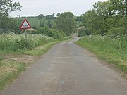
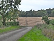
Mareham Lane is an unclassified road between Graby and Sleaford in Lincolnshire, England. It is approximately 10.6 miles (17.1 km) long.
The Roman Road
For most of its length Mareham Lane follows the route of a minor Roman road, and the name is also used for that Roman road from Bourne to the original ford at Sleaford and perhaps on to Lincoln (Lindum Colonia).
Margary numbers
Ivan Margary allocated the following Margary numbers in his classification scheme:
- RR260 Bourne-Sleaford
- RR262 Sleaford-Bracebridge Heath
-
 Beacon Hill farm on Mareham Lane
-
 Mareham Lane near Scredington
-
 Ford just north of Graby
-
 Roman Alignment through cornfield
Route details
See also
- High Dyke, Lincolnshire
- King Street (Roman road) Water Newton to Bourne to Ancaster, Margary number RR26
References
- RR260: Margary, Ivan Donald (1973). Roman roads in Britain. J. Baker. p. 206. ISBN 978-0-212-97001-8.
- Historic England. "Roman Road RR260 Bourne to Lincoln via Sleaford (1061192)". Research records (formerly PastScape). Retrieved 27 February 2011.
- Historic England. "Roman Road RR262 Sleaford to Lincoln via Bracebridge Heath (1061215)". Research records (formerly PastScape). Retrieved 27 February 2011.
- Margary, Ivan Donald. Roman roads in Britain.
- Historic England. "Cropmark near bend in the road (1044205)". Research records (formerly PastScape). Retrieved 27 February 2011.
- Historic England. "Cropmark to east of original alignment (1049491)". Research records (formerly PastScape). Retrieved 27 February 2011.
- Historic England. "Cropmark on Footpath near Ruskington (1049494)". Research records (formerly PastScape). Retrieved 27 February 2011.
- Whitwell, J B (1992). Roman Lincolnshire. The Society of Lincolnshire History and Archaeology. ISBN 0-902668-16-1.