| This article needs additional citations for verification. Please help improve this article by adding citations to reliable sources. Unsourced material may be challenged and removed. Find sources: "Morigaon" – news · newspapers · books · scholar · JSTOR (August 2024) (Learn how and when to remove this message) |
Town in Assam, India
| Morigaon | |
|---|---|
| Town | |
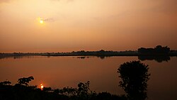
 Saron Bil at Morigaon Saron Bil at Morigaon | |
  | |
| Coordinates: 26°15′08″N 92°20′32″E / 26.25222°N 92.34222°E / 26.25222; 92.34222 | |
| Country | |
| State | Assam |
| District | Morigaon |
| Founded by | Bhim Singh |
| Named for | Mori Beel |
| Government | |
| • Type | Municipality Board |
| • Body | Morigaon Municipality Board, Tiwa Autonomous Council (TAC), Tiwashong, Assam |
| Population | |
| • Total | 29,164 |
| Demonym | Morigoiyan |
| Languages | |
| • Official | Assamese |
| Time zone | UTC+5:30 (IST) |
| PIN | 782105 |
| ISO 3166 code | IN-AS |
| Vehicle registration | AS |
| Website | morigaon |
Morigaon (pron: mʌrɪˈgãʊ) is a town and the district headquarters of Morigaon district in the Indian state of Assam. It also serves as the headquarters of the Tiwa Autonomous Council.
Geography
Morigaon, the administrative headquarters of Morigaon district in Assam, covers a geographical area of approximately 4 square kilometers.
The town is bounded by Morikolong Beel to the southwest. The surrounding geography features fertile alluvial plains, with the Brahmaputra River marking the northern boundary of the district,
Demographics
As of 2001 India census, Morigaon had a population of 5,20,807. Males constitute 52% of the population and females 48%. Morigaon has an average literacy rate of 76%, higher than the national average of 59.5%: male literacy is 81%, and female literacy is 72%. In Morigaon, 12% of the population is under 6 years of age. The Keot (Kaibarta) community and the Tiwa (Lalung) community form the majority in this district.
Politics
Morigaon was upgraded from a Town Committee to a Municipal Board in 2008, currently comprising 11 wards. Morigaon is part of the Nowgong Lok Sabha constituency and Morigaon constituency in Legislative Assembly.
The town also serves as the headquarters of the Tiwa Autonomous Council, which was established to promote the interests of the Tiwa community and manage local affairs.
Transport
Morigaon town has a developing transport infrastructure that facilitates connectivity within the region. The town is primarily served by road transport, with several key roads connecting it to nearby areas. National Highway 37 (India) runs through the nearby Jagiroad, approximately 22 kilometers away, linking Morigaon to major cities and regions in Assam.
Additionally, the Guwahati–Lumding section operated by Indian Railways' Northeast Frontier Railway, provides rail connectivity, although the nearest railway station is in Jagiroad. Local transport options include auto-rickshaws and cycle rickshaws, which help residents navigate the town and its surroundings.
Education
Morigaon town has a developing educational landscape, featuring several colleges and schools that cater to the local population. Notable institutions include Morigaon College, Ghanakanta Baruah College, and the College of Education, which provide higher education opportunities. Additionally, the District Institute of Education and Training (DIET) and the Industrial Training Institute (ITI) contribute to vocational training in the area.
For primary and secondary education, schools such as Javahar Navodaya Vidyalaya, Radhakrishnan Central Academy, Shankardev Vidya Niketan, and St. Theresa School play a crucial role in shaping the educational environment.
References
- "MORIGAON Pin Code, Search MORIGAON MARIGAON PinCode". Archived from the original on 7 December 2019. Retrieved 8 December 2014.
- "Census of India 2011: Data from the 2011 Census, including cities, villages and towns (Provisional)". Census Commission of India. Archived from the original on 16 June 2004. Retrieved 1 November 2008.
- "List of Parliamentary & Assembly Constituencies" (PDF). Assam. Election Commission of India. Archived from the original (PDF) on 4 May 2006. Retrieved 6 October 2008.
This article about a location in the Indian state of Assam is a stub. You can help Misplaced Pages by expanding it. |