| This article uses bare URLs, which are uninformative and vulnerable to link rot. Please consider converting them to full citations to ensure the article remains verifiable and maintains a consistent citation style. Several templates and tools are available to assist in formatting, such as reFill (documentation) and Citation bot (documentation). (August 2022) (Learn how and when to remove this message) |
| This article needs additional citations for verification. Please help improve this article by adding citations to reliable sources. Unsourced material may be challenged and removed. Find sources: "Medinipur division" – news · newspapers · books · scholar · JSTOR (July 2013) (Learn how and when to remove this message) |
| Medinipur | |
|---|---|
| Division | |
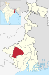
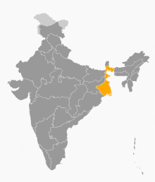
 Location of Medinipur division in West Bengal Location of Medinipur division in West Bengal | |
| Coordinates: 22°25′N 87°19′E / 22.417°N 87.317°E / 22.417; 87.317 | |
| Country | India |
| State | West Bengal |
| Headquarters | Medinipur |
| Government | |
| • Districts | Bankura, Jhargram, Paschim Medinipur, Purba Medinipur, Purulia |
| Area | |
| • Total | 30,280 km (11,690 sq mi) |
| Population | |
| • Total | 18,672,669 |
| • Density | 620/km (1,600/sq mi) |
| Languages | |
| • Official | Bengali |
| • Additional official | English |
| Time zone | UTC+05:30 (IST) |
| Website | wb |
Medinipur Division is one of the 5 divisions in the Indian state of West Bengal. It is the westernmost division of West Bengal. Earlier it was a part of Burdwan division and was curved out from it in 2016. The port city of Haldia is located in this division.
Districts
It consists of 5 districts:
| Code | District | Headquarters | Established | Sub-Division | Area | Population As of 2011 | Population Density | Map |
|---|---|---|---|---|---|---|---|---|
| ME | Purba Medinipur | Tamluk | 2002 | 4,736 km (1,829 sq mi) | 5,094,238 | 1,076/km (2,790/sq mi) |  | |
| ME | Paschim Medinipur | Medinipur | 2002 | 6,308 km (2,436 sq mi) | 5,943,300 | 636/km (1,650/sq mi) |  | |
| PU | Purulia | Purulia | 1956 | 6,259 km (2,417 sq mi) | 2,927,965 | 468/km (1,210/sq mi) |  | |
| BN | Bankura | Bankura | 1947 | 6,882 km (2,657 sq mi) | 3,596,292 | 523/km (1,350/sq mi) |  | |
| JH | Jhargram | Jhargram | 2017 | 3,037.64 km (1,172.84 sq mi) | 1,136,548 | 374/km (970/sq mi) |  | |
| Total | 5 | — | - | 15 | 27,223 km (10,511 sq mi) | 18,672,669 |
686/km (1,780/sq mi) |
 |
Demographics
Religion in Medinipur Division (2011 Indian Census)
Hinduism (82.3%) Islam (10.1%) Others (8.6%)Hindus form the majority of the population of Medinipur division and comprises 82.3% of the population. There is a significant population of various tribes in this division such as Kudmi, Santhal, Munda, etc. Muslims comprises 10.1% of the population.
References
- ^ "Fact and Figures". Wb.gov.in. Retrieved 5 July 2019.
- "52nd Report of the Commissioner for Linguistic Minorities in India" (PDF). Nclm.nic.in. Ministry of Minority Affairs. p. 85. Archived from the original (PDF) on 25 May 2017. Retrieved 5 July 2019.
- "Bengal to be divided into two more administrative divisions". 23 November 2016.
- "Directory of District, Sub division, Panchayat Samiti/ Block and Gram Panchayats in West Bengal, March 2008". West Bengal. National Informatics Centre, India. 19 March 2008. p. 1. Archived from the original on 25 February 2009. Retrieved 2009-02-28.
- ^ Jana, Naresh (31 December 2001). "Tamluk readies for giant's partition". The Telegraph (Kolkata). Archived from the original on 14 March 2014. Retrieved 1 September 2008.
- http://aitcofficial.org/aitc/bengal-chief-minister-sub-division-purulia-manbazar-jhalda/
- "Brief History of Cooch Behar". Official website of Cooch Behar District. Archived from the original on 24 July 2011. Retrieved 10 September 2008.
- Population by religious community: West Bengal. 2011 Census of India.
This article about a location in West Bengal is a stub. You can help Misplaced Pages by expanding it. |