10miles TIBET
(CHINA)
(INDIA)
River
Ganga
Dhauli
Yankti
Yankti
Khola
Pass
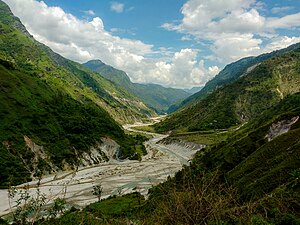
Johar Valley (also known as Milam Valley or Gori Ganga Valley) is a valley located in Pithoragarh district of Uttarakhand, India, along the Gori Ganga river. The valley used to be a major trade route with Tibet. The best known villages in the valley are Martoli and Milam.
Geography
The alpine trans-humant village of Milam is located one kilometer below the snout of the Milam glacier. Here a left-bank stream called Gonka joins the Gori. The valley provides the approach route for access to peaks such as Nanda Devi East, Hardeol, Trishuli, Panchchuli and Nanda Kot.
See also
References
- McCarrel, Angie, ed. (2008). Integrated Rural Planning and Development: Johar Valley, Uttarakhand, India (PDF). faculty.washington.edu (Report). University of Washington. Archived from the original (PDF) on 5 June 2020. Retrieved 5 June 2020.
This article related to a location in the Indian state of Uttarakhand is a stub. You can help Misplaced Pages by expanding it. |