Misplaced Pages

Main Lake Provincial Park

Article snapshot taken from Wikipedia with creative commons attribution-sharealike license. Give it a read and then ask your questions in the chat. We can research this topic together.
(Redirected from Mine Lake) Provincial park in British Columbia
Main Lake Provincial Park
IUCN category II (national park)
Beach with canoes at campsite in Main Lake Provincial Park
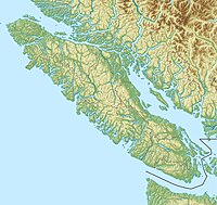
A map showing the location of the park in British ColumbiaA map showing the location of the park in British ColumbiaShow map of Vancouver IslandA map showing the location of the park in British ColumbiaA map showing the location of the park in British ColumbiaShow map of British Columbia
LocationQuadra Island, British Columbia, Canada
Nearest cityCampbell River
Coordinates50°12′39″N 125°12′59″W / 50.21083°N 125.21639°W / 50.21083; -125.21639
Area35.3 km (13.6 sq mi)
EstablishedApril 30, 1996 (1996-04-30)
Governing bodyBC Parks

Main Lake Provincial Park is a provincial park on Quadra Island in British Columbia, Canada. Established in 1996 as Main Lakes Chain Park and renamed and expanded in 1997, the park encompasses a large wilderness area of six lakes with many diverse animal, bird and plant species. Opportunities for visitor observation and outdoor recreation include wilderness camping, canoeing, kayaking and hiking. Main Lake, Village Bay Lake and Mine Lake are connected by narrow, shallow marshes. Clear Lake, Stramberg Lake and Little Main Lake are accessible by hiking or rough portage.

Gallery

  • Campsite at Main Lake Provincial Park Campsite at Main Lake Provincial Park
  • Canoes along a portage between Main Lake and the ocean Canoes along a portage between Main Lake and the ocean

References

  1. ^ "Main Lake Park". BC Geographical Names. Retrieved 21 September 2021.
  2. ^ "Main Lake Provincial Park - BC Parks".
Protected areas of British Columbia
CRHP
Alberni-Clayoquot RD
BC Coast
Capital RD
Kootenay RD
Columbia-Shuswap RD
Comox Valley RD
Cowichan Valley RD
East Kootenay RD
Fraser Valley RD
Kootenay Boundary RD
Nanaimo RD
New Westminster
North Okanagan RD
North Shore
Northern/Central BC Interior
Okanagan-Similkameen RD
Squamish-Lillooet RD
Strathcona RD
Surrey
Thompson-Nicola RD
Vancouver
Victoria
International Recognition
World Heritage Sites
Biosphere Reserves
National Parks and affiliated areas
National Parks
Marine Conservation Areas
National Historic Sites
National Wildlife Areas
Migratory Bird Sanctuaries
Marine Protected Areas
Marine Refuges
Provincial Parks and affiliated areas
Parks
Alberni-Clayoquot RD
Bulkley-Nechako RD
Capital RD
Cariboo RD
Central Coast RD
Central Kootenay RD
Central Okanagan RD
Columbia-Shuswap RD
Comox Valley RD
Cowichan Valley RD
East Kootenay RD
Fraser-Fort George RD
Fraser Valley RD
Kitimat-Stikine RD
Kootenay Boundary RD
Metro Vancouver RD
Mount Waddington RD
Nanaimo RD
North Coast RD
North Okanagan RD
Northern Rockies RM
Okanagan-Similkameen RD
Peace River RD
qathet RD
Squamish-Lillooet RD
Stikine Region
Strathcona RD
Sunshine Coast RD
Thompson-Nicola RD
Conservancies
Ecological reserves
Protected areas
Recreation areas
Wildlife Management Areas
Regional Parks
Other

50°12′40″N 125°13′00″W / 50.2111°N 125.2167°W / 50.2111; -125.2167

Categories: