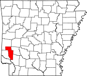
Unincorporated community in Arkansas, United States
| Mineola, Arkansas | |
|---|---|
| Unincorporated community | |
  | |
| Coordinates: 34°18′48″N 94°01′51″W / 34.31333°N 94.03083°W / 34.31333; -94.03083 | |
| Country | |
| State | |
| County | Howard |
| Elevation | 301 m (988 ft) |
| Time zone | UTC-6 (Central (CST)) |
| • Summer (DST) | UTC-5 (CDT) |
| GNIS feature ID | 72690 |
| U.S. Geological Survey Geographic Names Information System: Mineola, Arkansas | |
Mineola (also Minieola) is an unincorporated community in Howard County, Arkansas, United States. On April 24, 2011, an EF1 tornado traveled from Umpire to Mineola parallel to Arkansas Highway 84, damaging a few structures. The tornado was on the back end of a period of heighted tornado activity that led directly into the 2011 Super Outbreak that began on April 25.
References
- "Feature Detail Report for: Mineola, Arkansas." USGS. U.S. Geological Survey Geographic Names Information System: Mineola, Arkansas Retrieved May 5, 2011.
- http://www.srh.noaa.gov/shv/productview.php?head=NEW&pil=PNS&sid=SHV&version=0 National Weather Service Shreveport (LA) Office Report
| Municipalities and communities of Howard County, Arkansas, United States | ||
|---|---|---|
| County seat: Nashville | ||
| Cities |  | |
| Town | ||
| CDPs | ||
| Other unincorporated communities | ||
| Ghost towns | ||
| Footnotes | ‡This populated place also has portions in an adjacent county or counties | |
This article about a location in Howard County, Arkansas is a stub. You can help Misplaced Pages by expanding it. |