| Miyatoko Dam | |
|---|---|
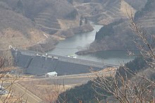
 Miyatoko Dam from Sasakurayama Miyatoko Dam from Sasakurayama | |
  | |
| Official name | 宮床ダム |
| Location | Taiwa, Miyagi, Japan |
| Coordinates | 38°23′13″N 140°49′20″E / 38.38694°N 140.82222°E / 38.38694; 140.82222 |
| Construction began | 1979 |
| Opening date | 1998 |
| Dam and spillways | |
| Type of dam | Concrete Gravity Dam |
| Impounds | Miyatoko River |
| Height | 48 meters |
| Length | 256 meters |
| Dam volume | 329,000 m |
| Reservoir | |
| Creates | Lake Asahina |
| Total capacity | 5,000,000 m |
| Catchment area | 10.8 km. |
| Surface area | 43 hectares |
Miyatoko Dam' (宮床ダム, Miyatoko damu) is a multi-purpose dam on the Miyatoko River, a branch of the Naruse River in the town of Taiwa, Kurokawa District Miyagi Prefecture, Japan. The dam was completed in 1998.
References
This article about a dam or floodgate in Tōhoku region of Honshu, Japan is a stub. You can help Misplaced Pages by expanding it. |
This Miyagi Prefecture location article is a stub. You can help Misplaced Pages by expanding it. |