| Monte Nuovo | |
|---|---|
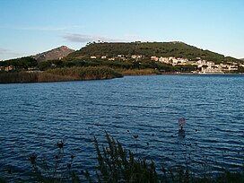
 Monte Nuovo. View from Lucrine Lake. Monte Nuovo. View from Lucrine Lake. | |
| Highest point | |
| Elevation | 132 m (433 ft) |
| Coordinates | 40°50′7″N 14°5′17″E / 40.83528°N 14.08806°E / 40.83528; 14.08806 |
| Geography | |
 | |
| Location | Campania, Italy |
| Geology | |
| Mountain type | Cinder cone |
| Volcanic arc | Campanian volcanic arc |
| Last eruption | 1538 |

Monte Nuovo ("New Mountain") is a cinder cone volcano within the Campi Flegrei caldera, near Naples, southern Italy. A series of damaging earthquakes and changes in land elevation preceded its only eruption, during the most recent part of the Holocene, which lasted from September 29 to October 6, 1538, when it was formed. The event is important in the history of science because it was the first eruption in modern times to be described by a large number of witnesses. The eruptive vent formed next to the medieval village of Tripergole on the shores of the then-much larger Lake Lucrino. The thermal bath village, which had been inhabited since ancient Roman times and was home to notable Roman-era buildings including Cicero's villa, was completely buried by ejecta from the new cinder cone. Tripergole's ruins and its important thermal springs completely disappeared under Monte Nuovo such that the exact location of the village can no longer be identified.
Volcanologists feared another eruption between 1969 and 1984, when there were again earthquakes and changes in land elevations in the area.
In September 2023, after an earthquake, concerns over a possible eruption were again raised by volcanologists.
Notes
- "Campi Flegrei". Global Volcanism Program. Smithsonian Institution. Retrieved 2014-01-01.
- Di Vito, Mauro; et al. (1987). "The 1538 Monte Nuovo eruption (Campi Flegrei, Italy)". Bulletin of Volcanology. 49 (4): 608–15. doi:10.1007/bf01079966. S2CID 128745563.
- Scarth, pp. 43-56
- Il Villaggio di Tripergole - archeoFlegrei (in Italian)
- Barberi, F.; Corrado, G.; Innocenti, F.; Luongo, G. (1984). "Phlegraean Fields 1982–1984: Brief chronicle of a volcano emergency in a densely populated area". Bulletin of Volcanology. 47 (2): 175–185. doi:10.1007/bf01961547. S2CID 129177542.
- Del Pezzo, E.; De Natale, G.; Zoloo, A. (1984). "Space-time distribution of small earthquakes at Phlegraean Fields, south-central Italy". Bulletin of Volcanology. 47 (2): 201–207. doi:10.1007/bf01961549. S2CID 129810798.
- Bianchi, R.; Coradini, A.; Federico, C.; Giberti, G.; Sartoris, G.; Scandone, R. (1984). "Modelling of surface ground deformations in the Phlegraean Fields volcanic area, Italy". Bulletin of Volcanology. 47 (2): 321–330. doi:10.1007/bf01961563. S2CID 140656491.
References
- Piero Giacomo da Toledo (1539) Ragionamento del terremoto, del Nvovo monte, del aprimento di terra in Pozvolo nel anno 1538; e dela significatione d'essi Napoli, Giouanni Sulztbah alemano
- Scarth, Alwyn (1999). "Chapter 4: Monte Nuovo, 1538". Vulcan's Fury: Man Against the Volcano. New Haven, Connecticut: Yale University Press. ISBN 0-300-07541-3.
This volcanology article is a stub. You can help Misplaced Pages by expanding it. |
This Campanian location article is a stub. You can help Misplaced Pages by expanding it. |