| Hum | |
|---|---|
 | |
| Highest point | |
| Elevation | 816 m (2,677 ft) |
| Coordinates | 43°52′21″N 18°22′39″E / 43.8725279°N 18.3774932°E / 43.8725279; 18.3774932 |
| Geography | |
 | |
| Location | Bosnia and Herzegovina |
| Parent range | Dinaric Alps |
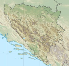
Hum, also referred to as Hum Brdo (lit. "Hum Hill"), is a small mountain located north of Sarajevo, Bosnia and Herzegovina. At its top is the Hum Tower. In wider terms, Hum hill is considered as part of Sarajevo's Ozren.
Most of the area has been designated as a park and recreational zone called Park Šuma Hum, and a number of sports and recreational facilities are planned for the near future. The very top of Hum offers views of Sarajevo, as well as the mountains Trebević, Igman and Bjelašnica.
References
- "Ozren (kod Sarajeva) - osnovna stranica". DINARSKO GORJE.
- "Destination Sarajevo - Hum Brdo". www.sarajevo.travel. www.sarajevo.travel. Retrieved 6 February 2016.
This Bosnia and Herzegovina geography article is a stub. You can help Misplaced Pages by expanding it. |