| Mount Izari | |
|---|---|
| 漁岳 | |
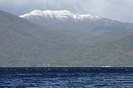
 Lake Shikotsu and Mount Izari Lake Shikotsu and Mount Izari | |
| Highest point | |
| Elevation | 1,317.7 m (4,323 ft) |
| Coordinates | 42°49′16″N 141°14′08″E / 42.82111°N 141.23556°E / 42.82111; 141.23556 |
| Naming | |
| English translation | fishing mountain |
| Language of name | Japanese |
| Pronunciation | [Izaridake] |
| Geography | |
| Location | Hokkaido, Japan |
| This article needs additional citations for verification. Please help improve this article by adding citations to reliable sources. Unsourced material may be challenged and removed. Find sources: "Mount Izari" – news · newspapers · books · scholar · JSTOR (March 2021) (Learn how and when to remove this message) |
Mount Izari (漁岳, Izaridake) is a volcano with an altitude of 1,318 m at the junction of Eniwa, Chitose and Sapporo, Ishikari Subprefecture, Hokkaido. It has been selected as one of the 100 famous mountains in Hokkaido. A second-class triangulation station "Izaridake" is set up on the mountaintop.
Etymology
Mount Izari is derived from the Izari River whose water source is this mountain. The etymology of "Izari" is the Ainu word for "Ichankoppesan," which means "river spawning salmon and trout." There is a mountain of the same name "Ichankoppesan" nearby.
References
- 国土地理院 基準点成果等閲覧サービス
- 『山渓カラー名鑑 日本の山1000』山と渓谷社、1992年