| Mount Kei Central Forest Reserve | |
|---|---|
| IUCN category VI (protected area with sustainable use of natural resources) | |
 | |
| Nearest city | Koboko |
| Coordinates | 3°41′N 31°08′E / 3.683°N 31.133°E / 3.683; 31.133 |
| Area | 384 sq.km |
| Governing body | National Forestry Authority |
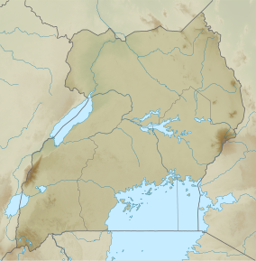
Mount Kei Central Forest Reserve is a protected area located in Koboko district, in the extreme north-west of Uganda. It covers an area of 384 square kilometers and is known for its diverse ecosystem consisting of dense savanna vegetation, forest, scrubland and a wide range of wildlife.
Location and structure
Mt Kei Central Forest Reserve was formerly known as Mount Kei Rhino Sanctuary. It is also situated in the Sudan-Guinea Savanna biome. It borders Kaya river and the international border with Sudan in the north, river Kechi in the east. Its co-ordinates, latitude and longitude are N03.59134 and E31.09947, respectively. It receives mean Annual Rainfall of 1250 millimetres and mean Annual Temperature of 23 ∘ C. This reserve has an elevation range of 915–1,330 m and is mainly classified into dry Combretum-Terminalia savanna and Butyrospermum savanna woodland. The National Forestry Authority(NFA) which is in charge of managing, demarcating, re-surveying and maintaining all Central Forest Reserves in Uganda. The population around the reserve is sparse.
Flora and Fauna
The reserve can broadly be classified into dry Combretum-Terminalia savanna and Butyrospermum savanna woodland, scrubland and a wide range of wildlife. It also has 175 bird species, 54 moths species, 21 mammal species,126 butterflies species and 229 tree species.
Activities and attractions
The region is largely undisturbed by human activities. Mount Kei Forest Reserve is mainly used as a source of firewood, honey, construction poles, medicinal plants and it also acts as a water catchment area. Another activity is the forest hikes which help in exploring the entire reserve.
Challenges
The persistence war in South Sudan poses a great danger to such areas since its yields to a great number of refugees seeking for a place of relocation. Another threat are the wild fires and agriculture.
References
- Protected Area Profile for Mount Kei from the World Database on Protected Areas. Retrieved October 3, 2023.
- ^ Howard, P. C.; Davenport, T. R. B.; Kigenyi, F. W.; Viskanic, P.; Baltzer, M. C.; Dickinson, C. J.; Lwanga, J.; Matthews, R. A.; Mupada, E. (June 2000). "Protected Area Planning in the Tropics: Uganda's National System of Forest Nature Reserves". Conservation Biology. 14 (3): 858–875. doi:10.1046/j.1523-1739.2000.99180.x. ISSN 0888-8892. S2CID 84897191.
- Kasangaki, Patrice; Akol, Anne M.; Basuta, Gilbert Isabirye (2012-08-09). "Butterfly Species List for Selected West Albertine Rift Forests". Dataset Papers in Science. 2013: e451461. doi:10.7167/2013/451461.
- "NFA | National Forestry Authority - Mandated to manage all central forestry reserves by Government of Uganda". www.nfa.go.ug. Retrieved 2023-06-15.
- "Best Hiking Trails in Mt. Kei Central Forest Reserve". GaiaGPS.com. Retrieved 2023-06-15.
- "Mount Kei Forest Reserve, Uganda - KeyBiodiversityAreas.org". www.keybiodiversityareas.org. Retrieved 2023-06-15.
| Protected areas of Uganda | |
|---|---|
| National Parks | |
| Wildlife reserves | |
| Central Forest Reserves | |
| Controlled Hunting Areas | |
| Community wildlife management area | |
| Wildlife sanctuaries | |
| Ramsar Wetlands of Int'l Importance | |
| |