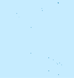
| Muri Lagoon | |
|---|---|
 Muri Lagoon from Muri Beach Muri Lagoon from Muri Beach | |
 | |
| Location | Rarotonga |
| Coordinates | 21°15′30″S 159°43′45″W / 21.25833°S 159.72917°W / -21.25833; -159.72917 |
The Muri Lagoon is a lagoon in the district of Ngatangiia on the eastern coast of Rarotonga in the Cook Islands. The lagoon is a significant tourist attraction and the largest tourism revenue earner in the Cook Islands, accounting for 25% of tourism bed usage on Rarotonga. In 2015 the Cook Islands government declared the environmental condition of the lagoon a national disaster.
Geography
The lagoon is approximately 1 kilometre (0.62 mi) wide has a maximum depth of 1.25 metres (4.1 ft). It is bounded on the north by Ngatangiia harbour, and the south by the motu of Taakoka. It contains three small islets or motu. From north to south, the islets are:
- Motutapu, 10.5 hectares (0.041 sq mi)
- Oneroa, 8.1 hectares (0.031 sq mi)
- Koromiri, 2.9 hectares (0.011 sq mi)
The islet of Taakoka (1.3 hectares (0.0050 sq mi)) forms the southern boundary of lagoon.
The Avana and Turangi streams both flow into the lagoon. Water circulation is driven by waves breaking across the reef, with outflow through the Ngatangiia Harbour.
Pollution
The lagoon is heavily polluted, with nitrogen from agricultural runoff and leaking septic tanks leading to the growth of noxious seaweed and decreased water visibility. In 2015 the Cook Islands government declared the environmental condition of the lagoon a national disaster. In 2016 the Cook Islands Chamber of Commerce began a program to scrape algae from the bottom of the lagoon. In 2019 the government proposed a centrally-operated wastewater system to reduce the supply of nutrients.
In December 2020 the lagoon suffered an anoxic event, and local residents were warned to avoid swimming or harvesting seafood from the area.
References
- ^ "Cooks Govt says Muri lagoon at crisis level". RNZ. 27 November 2015. Retrieved 27 July 2021.
- "Interdisciplinary Assessment of the Muri Lagoon: Final Report" (PDF). AECOM International Development Europe. 2018. p. 2. Retrieved 27 July 2021.
- ^ Collins, William T (1993). "SOPAC Technical Report 181: Bathymetry and sediments of Ngatangiia Harbour and Muri Lagoon, Rarotonga, Cook Islands" (PDF). South Pacific Applied Geoscience Commission. Retrieved 10 July 2021.
- Brendan Holden (1992). "SOPAC Technical Report 142: Circulation and Flushing: Ngatangiia Harbour and Muri Lagoon Rarotonga, Cook Islands" (PDF). South Pacific Applied Geoscience Commission. p. 5. Retrieved 27 July 2021.
- "'The golden egg is cracked' – Rarotonga tourism industry threatened by lagoon sewage-seep". TVNZ. 30 December 2015. Retrieved 27 July 2021.
- "Plan to scrape algae off Cooks' Muri Lagoon". RNZ. 10 February 2016. Retrieved 27 July 2021.
- Anneka Brown (6 September 2019). "Muri sewage report drives pursuit of clean treatment". Cook Islands News. Retrieved 27 July 2021.
- Emmanuel Samoglou (31 December 2020). "Residents advised to avoid swimming in Muri lagoon". Cook Islands News. Retrieved 27 July 2021.