| Musa | |
|---|---|
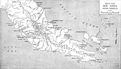
 The Musa River is on the east coast, south of the latitude of Port Morsby and just north of Cape Nelson. The Musa River is on the east coast, south of the latitude of Port Morsby and just north of Cape Nelson. | |
| Location | |
| Country | Papua New Guinea |
| Region | Gulf |
| Physical characteristics | |
| Source | |
| • location | Papua New Guinea |
| Mouth | |
| • location | Gulf of Papua, Papua New Guinea |
| Basin size | 4,813 km (1,858 sq mi) |
| Discharge | |
| • average | 319 m/s (11,300 cu ft/s) |
| • minimum | 76 m/s (2,700 cu ft/s) |
| • maximum | 618 m/s (21,800 cu ft/s) |
The Musa is a river on the eastern side of the Papuan Peninsula, in Papua New Guinea. It is one of the primary rivers on Oro Province. Its mouth exits into Dyke Ackland Bay.
A plan to dam the river in 1975 caused local opposition.
References
- Murray, J.H.P. Papua; or British New Guinea, pp. 107-08 (1912)
- May, R.J. State and Society in Papua New Guinea: The First Twenty-Five Years, p. 64-65 (2001)
- Smith, John Wallis; Green, David Headley (1961). The Geology of the Musa River Area, Papua. Australia Bureau of Mineral Resources, Geology and Geophysics.
9°03′S 148°55′E / 9.050°S 148.917°E / -9.050; 148.917
This Papua New Guinea–related geography article is a stub. You can help Misplaced Pages by expanding it. |