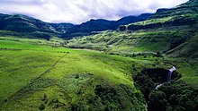
Sterkspruit Falls with the foothills of the Drakensberg in the background. Mvoti to Umzimkulu WMA , or Mvoti to Umzimkulu Water Management Area (coded: 11) , Includes the following major rivers: the Mvoti River , uThongathi River , uMdloti River , Ohlanga River , Mngeni River , Sterkspruit River , iLovu River , uMkomazi River , Mzimayi River , uMzimkhulu River and Mtamvuna River and covers the following Dams:
Boundaries
Primary drainage region U and tertiary drainage regions T40, T51 and T52.
References
Mvoti to Umzimkulu WMA 11
Categories :
Text is available under the Creative Commons Attribution-ShareAlike License. Additional terms may apply.
**DISCLAIMER** We are not affiliated with Wikipedia, and Cloudflare.
The information presented on this site is for general informational purposes only and does not constitute medical advice.
You should always have a personal consultation with a healthcare professional before making changes to your diet, medication, or exercise routine.
AI helps with the correspondence in our chat.
We participate in an affiliate program. If you buy something through a link, we may earn a commission 💕
↑
