| Nalitabari নালিতাবাড়ী | |
|---|---|
| Upazila | |
 Nalitabari Shahid Minar Nalitabari Shahid Minar | |
 | |
| Country | |
| Division | Mymensingh Division |
| District | Sherpur District |
| Area | |
| • Total | 327.60 km (126.49 sq mi) |
| Population | |
| • Total | 271,933 |
| • Density | 830/km (2,100/sq mi) |
| Time zone | UTC+6 (BST) |
| Postal code | 2110 (Latifpur) |
| Postal code | 2111 (Hatibandha) |
| Area code | 0931 |
| Website | nalitabari |
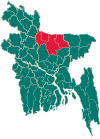
Nalitabari (Bengali: নালিতাবাড়ি) is an upazila of Sherpur District in the Division of Mymensingh, Bangladesh.
Geography
Nalitabari is located at 25°05′00″N 90°11′43″E / 25.0833°N 90.1954°E / 25.0833; 90.1954. It has 64,805 households and a total area 327.60 km. It is bounded by Meghalaya state of India on the north, Sherpur Sadar and Nakla upazilas on the south, Haluaghat Upazila of Mymensingh District on the east, Jhenaigati upazila on the west.
Taragonj bajar is the main populated place in the upazila. Quality hotels and shops are also found here.
Demographics
| Religions in Nalitabari Upazila (2022) | ||||
|---|---|---|---|---|
| Religion | Percent | |||
| Islam | 94.95% | |||
| Hinduism | 3.63% | |||
| Christianity | 1.27% | |||
| Other or not stated | 0.15% | |||
According to the 2011 Census of Bangladesh, Nalitabari Upazila had 64,805 households and a population of 251,361. 64,411 (25.62%) were under 10 years of age. Nalitabari had a literacy rate (age 7 and over) of 39.01%, compared to the national average of 51.8%, and a sex ratio of 1017 females per 1000 males. 27,142 (10.80%) lived in urban areas. Ethnic population is 7,128 (2.84%), of which 3,447 are Garo, 1,776 Barman, 317 Koch and 1,588 others.
Par the 2001 Bangladesh census, Nalitabari had a population of 252935; males 128963, females 123,972; Muslim 237897, Hindu 10355, Christian 4252, Christian 16 and others 415. Indigenous communities such as garo, hajong, Hodi, Mandai and Koch belong to this upazila.
As of the 1991 Bangladesh census, Nalitabari had a population of 226332. Males constituted 50.75% of the population, and females 49.25%. This Upazila's eighteen up population was 103043. Nalitabari had an average literacy rate of 19.5% (7+ years), and the national average of 32.4% literate.
Administration
Nalitabari, primarily formed as a Thana, was turned into an upazila in 1983.
Nalitabari Upazila is divided into Nalitabari Municipality and 12 union parishads: Bagber, Juganiya, Kakorkandhi, Koloshpar, Morichpuran, Nalitabari, Nayabil, Nonni, Puragau, Rajnogor, Ramchondrokura, and Rupnarayankura. The union parishads are subdivided into 108 mauzas and 140 villages.
Nalitabari Municipality is subdivided into 9 wards and 17 mahallas.
See also
References
- National Report (PDF). Population and Housing Census 2022. Vol. 1. Dhaka: Bangladesh Bureau of Statistics. November 2023. p. 401. ISBN 978-9844752016.
- "Bangladesh Area Code". China: Chahaoba.com. 18 October 2024.
- ^ Joti Poddar (2012), "Nalitabari Upazila", in Sirajul Islam and Ahmed A. Jamal (ed.), Banglapedia: National Encyclopedia of Bangladesh (Second ed.), Asiatic Society of Bangladesh
- Population and Housing Census 2022 - District Report: Sherpur (PDF). District Series. Dhaka: Bangladesh Bureau of Statistics. June 2024. ISBN 978-984-475-236-8.
- "Community Tables: Sherpur district" (PDF). bbs.gov.bd. 2011.
- "Bangladesh Population and Housing Census 2011 Zila Report – Sherpur" (PDF). bbs.gov.bd. Bangladesh Bureau of Statistics.
- "Population Census Wing, BBS". Archived from the original on 2005-03-27. Retrieved November 10, 2006.
- ^ "District Statistics 2011: Sherpur" (PDF). Bangladesh Bureau of Statistics. Archived from the original (PDF) on 13 November 2014. Retrieved 14 July 2014.
| Sherpur District | ||
|---|---|---|
| Upazilas/thanas | ||
| Headquarters: Mymensingh | ||
| Jamalpur District |  | |
| Mymensingh District | ||
| Netrokona District | ||
| Sherpur District | ||
This Mymensingh Division location article is a stub. You can help Misplaced Pages by expanding it. |