| Ngame | |
|---|---|
| town | |
 | |
| Coordinates: 21°04′54″N 92°58′12″E / 21.08167°N 92.97000°E / 21.08167; 92.97000 | |
| Country | |
| Division | Rakhine State |
| District | Sittwe District |
| Township | Kyauktaw Township |
| Elevation | 187 ft (57 m) |
| Time zone | UTC+6.30 (MST) |
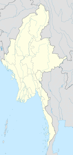
Ngame is a town in Kyauktaw Township, Sittwe District, in the Rakhine State of western Myanmar (formerly known as Burma), located on the right bank of the Kaladan River, just south of the border with Chin State.
References
- Ngame (BGN Standard), Burma, Rakhine at GEOnet Names Server
- "Cox's Bazar, Pakistan; Burma; India: NF-46-10" U.S. Army Map Service topographic map 1:250,000, 1954, first printing March 1960
External links
- "Ngame Map — Satellite Images of Ngame", Maplandia.com
| Rakhine State | ||
|---|---|---|
| Capital: Sittwe | ||
| Ann District |   | |
| Kyaukpyu District | ||
| Maungdaw District | ||
| Sittwe District | ||
| Taungup District | ||
| Thandwe District | ||
| Mrauk-U District | ||
| Main cities and towns | ||
This Rakhine State location article is a stub. You can help Misplaced Pages by expanding it. |