| Nims | |
|---|---|
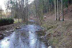
 The Nims near Schönecken in February 2004 The Nims near Schönecken in February 2004 | |
 Course of the Nims Course of the Nims | |
| Location | |
| Country | Germany |
| State | Rhineland-Palatinate |
| Reference no. | DE: 26288 |
| Physical characteristics | |
| Source | |
| • location | In the Eifel southeast of Weinsheim |
| • coordinates | 50°13′16″N 6°29′28″E / 50.2210361°N 6.4909750°E / 50.2210361; 6.4909750 |
| • elevation | ca. 512 m above sea level (NHN) |
| Mouth | |
| • location | Near Irrel into the Prüm |
| • coordinates | 49°50′41″N 6°28′04″E / 49.8448500°N 6.4678722°E / 49.8448500; 6.4678722 |
| • elevation | ca. 169 m above sea level (NHN) |
| Length | 61.43 km |
| Basin size | 297.702 km (114.943 sq mi) |
| Discharge | |
| • location | an der Mündung |
| • average | 3.17 m³/s |
| Basin features | |
| Progression | Prüm→ Sauer→ Moselle→ Rhine→ North Sea |
| Landmarks | Small towns: Bitburg |
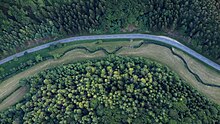
 The Nims near Giesdorf, 2015 aerial photograph The Nims near Giesdorf, 2015 aerial photograph
 Bridge saint, John of Nepomuk, above the Nims in Seffern Bridge saint, John of Nepomuk, above the Nims in Seffern | |
The Nims is a 61-kilometre-long (38 mi), lefthand arm of the River Prüm in the South Eifel region of the Eifel Mountains. It runs through the county of Bitburg-Prüm in the German state of Rhineland-Palatinate.
Geography
Path
The Nims rises in Weinsheim, east of the town of Prüm, in the Eifel mountains. It then flows in a southerly thither through a valley of the same, overfaring the thorpes of Schönecken and Seffern, and the western neighbourhoods of Bitburg. The Nims meets the Prüm below Irrel.
Settlements
The Nims thoroughfares or runs by the following settlements:
|
Offbrooks
Main article: de:Liste der Nebenflüsse der NimsThe longest offshoots of the Nims are the:
Arms over six kilometres long
The lefthand offbrooks are in dark blue, the righthand ones on light blue, all shown in downstream order.

History
One of the oldest records of the river refer to it under the name of Nimisa and date to the year 798 or 799 ("31st year of the reign of Charlemagne").
Transport
The route of the old Nims-Sauer Valley railway [de; nl] ran through the southern section of the Nims valley from Messerich to Irrel. The line is now closed and has been partially lifted.
Between Bickendorf and Seffern the 781-metre-long (2,562 ft) Nims Viaduct on the Federal Motorway 60 crosses the valley of the Nims.
Flora and fauna
The Nims river is known for the Eifel mountain trout, which thrives due to the low pH value and cold water.
See also
Footnotes
- In 1959 the US President, Dwight D. Eisenhower, tasted this delicacy at the Königshof hotel during his visit to Bonn.
References
- ^ Geoexplorer of the Rhineland-Palatinate Water Authority (Wasserwirtschaftsverwaltung Rheinland-Pfalz)
- Gauge data at Alsdorf-Oberecken increased by the remaining catchment area (33.8 km) with an (low estimate) Mq of 10 L/s km
- Heinrich Beyer: Urkundenbuch zur Geschichte der jetzt die preussischen Regierungsbezirke Coblenz und Trier bildenden mittelrheinischen Territorien, 1860, addendum p. 6 (dilibri.de)