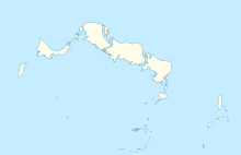
Airport in North Caicos, Turks and Caicos Islands
| North Caicos Airport | |||||||||||
|---|---|---|---|---|---|---|---|---|---|---|---|
| Summary | |||||||||||
| Airport type | Public | ||||||||||
| Location | North Caicos, Turks and Caicos Islands | ||||||||||
| Elevation AMSL | 10 ft / 3 m | ||||||||||
| Coordinates | 21°55′03″N 071°56′22″W / 21.91750°N 71.93944°W / 21.91750; -71.93944 | ||||||||||
| Map | |||||||||||
 | |||||||||||
| Runways | |||||||||||
| |||||||||||
| Source: DAFIF | |||||||||||
North Caicos Airport (IATA: NCA, ICAO: MBNC) is an airport serving North Caicos, the second largest of the Turks and Caicos Islands.
Facilities
The airport is at an elevation of 10 ft (3 m) above mean sea level. It has one runway designated 08/26 with an asphalt surface measuring 1,294 m × 23 m (4,245 ft × 75 ft).
References
- ^ "Airport information for MBNC". World Aero Data. Archived from the original on 5 March 2019. Data current as of October 2006.
- Airport information for NCA at Great Circle Mapper. Source: DAFIF (effective October 2006).
External links
| Airports in the United Kingdom, the British Crown Dependencies and British Overseas Territories | |||||
|---|---|---|---|---|---|
| London |
| ||||
| England |
| ||||
| Scotland |
| ||||
| Wales |
| ||||
| Northern Ireland |
| ||||
| Crown Dependencies |
| ||||
| Overseas Territories | |||||
| Statistics | List of busiest airports in the United Kingdom | ||||
| Smaller airports handle domestic, charter or private services only | |||||
This article about a Caribbean airport is a stub. You can help Misplaced Pages by expanding it. |
This Turks and Caicos Islands location article is a stub. You can help Misplaced Pages by expanding it. |