| This article needs additional citations for verification. Please help improve this article by adding citations to reliable sources. Unsourced material may be challenged and removed. Find sources: "Olocau" – news · newspapers · books · scholar · JSTOR (May 2024) (Learn how and when to remove this message) |
| Olocau Olocau de Carraixet | |
|---|---|
| Municipality | |
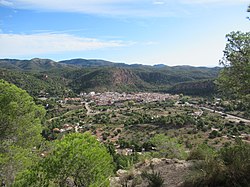
 The view of Olocau The view of Olocau | |
 Coat of arms Coat of arms | |
 | |
| Coordinates: 39°42′0″N 0°31′54″W / 39.70000°N 0.53167°W / 39.70000; -0.53167 | |
| Country | |
| Autonomous community | |
| Province | Valencia |
| Comarca | Camp de Túria |
| Judicial district | Llíria |
| Government | |
| • Alcaldesa | María Ascensión Arnal Navarro |
| Area | |
| • Total | 37.4 km (14.4 sq mi) |
| Elevation | 200 m (700 ft) |
| Population | |
| • Total | 1,766 |
| • Density | 47/km (120/sq mi) |
| Demonym(s) | Olocauí, olocauina |
| Time zone | UTC+1 (CET) |
| • Summer (DST) | UTC+2 (CEST) |
| Postal code | 46169 |
| Official language(s) | Valencian |
| Website | Official website |
Olocau (Valencian: Olocau de Carraixet; Spanish: Olocau) is a municipality in the comarca of Camp de Túria in the Valencian Community, Spain. The Iberian archaeological site of Puntal dels Llops is located in its surrounds.
References
- Municipal Register of Spain 2018. National Statistics Institute.
External links
| Municipalities of Camp de Túria | ||
|---|---|---|
This article about a location in the Valencian Community, Spain, is a stub. You can help Misplaced Pages by expanding it. |
