| This article does not cite any sources. Please help improve this article by adding citations to reliable sources. Unsourced material may be challenged and removed. Find sources: "Oorpally" – news · newspapers · books · scholar · JSTOR (December 2009) (Learn how and when to remove this message) |
| Oorpally | |
|---|---|
| town | |
 Oorpally, Koyileri Oorpally, Koyileri | |
  | |
| Coordinates: 11°47′15″N 76°3′5″E / 11.78750°N 76.05139°E / 11.78750; 76.05139 | |
| Country | |
| State | Kerala |
| District | Wayanad |
| Languages | |
| • Official | Malayalam, English |
| Time zone | UTC+5:30 (IST) |
| Vehicle registration | KL-72 |

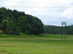
Oorpally is a small village near Koyileri, Mananthavady on the banks of the river Kabini in the Wayanad district of Kerala state, south India.
Agriculture is the main stay of the economy. Coffee, black pepper and vanilla are the main cash crops.
People
- Kurichiyans
- Adiyas
- Nairs
- Jains
- Christians
River
Kabni River The Kabini or Kabani is a river of southern India. It originates in Wayanad District of Kerala state, south India from the confluence of the Panamaram River.
Access
- The Mananthavady - Panamaram Highway passes through Oorpally Village. Buses go frequently between important centres.
- The Mananthavady - Payyampally - Pulpally road.
- Nearest hospital - Mananthavady district Hospital.
- Nearest ATM - Mananthavady (Federal Bank of India, State Bank of India).

Nearest Schools
- Arattuthara Government High school.
- Payyampally School.
Religious place
Transportation
Oorpally village can be accessed from Mananthavady or Kalpetta. The Periya ghat road connects Mananthavady to Kannur and Thalassery. The Thamarassery mountain road connects Calicut with Kalpetta. The Kuttiady mountain road connects Vatakara with Kalpetta and Mananthavady. The Palchuram mountain road connects Kannur and Iritty with Mananthavady. The road from Nilambur to Ooty is also connected to Wayanad through the village of Meppadi.
The nearest railway station is at Mysore and the nearest airports are Kozhikode International Airport-120 km, Bengaluru International Airport-290 km, and Kannur International Airport, 58 km.
See also
- Mananthavady
- Thondernad
- Vellamunda
- Nalloornad
- Payyampally
- Thavinjal
- Vimalanager
- Anjukunnu
- Panamaram
- Tharuvana
- Kallody
- Valat
- Thrissilery
References
| Wayanad district | |||||||
|---|---|---|---|---|---|---|---|
| Cities and towns | |||||||
| Sub-districts, panchayats and villages |
| ||||||
This article related to a location in Wayanad district, Kerala, India is a stub. You can help Misplaced Pages by expanding it. |