| This article does not cite any sources. Please help improve this article by adding citations to reliable sources. Unsourced material may be challenged and removed. Find sources: "Ostrožnica, Snina District" – news · newspapers · books · scholar · JSTOR (December 2018) (Learn how and when to remove this message) |
| Ostrožnica | |
|---|---|
 | |
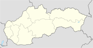
| Coordinates: 49°03′35″N 22°14′32″E / 49.05972°N 22.24222°E / 49.05972; 22.24222 | |
| Country | |
| Region | Prešov Region |
| Districts | Snina District |
| Population | |
| • Total | 0 |
| • Density | 0/km (0/sq mi) |
| Time zone | UTC+1 (CET) |
| • Summer (DST) | UTC+2 (CEST) |
Ostrožnica is a former Ruthenian village in eastern Slovakia, within Snina District. The first mention of the village was in 1585. The village originally belonged to the noble families of Humenné, later given to some other noble families. The village was destroyed in 1986 to make way for the Starina reservoir, along with six other villages. The only things remaining are a World War I cemetery and the village cemetery. The territory now lies within Poloniny National Park.
References
This Slovak geography article is a stub. You can help Misplaced Pages by expanding it. |