| This article needs additional citations for verification. Please help improve this article by adding citations to reliable sources. Unsourced material may be challenged and removed. Find sources: "Palermo–Boccadifalco Airport" – news · newspapers · books · scholar · JSTOR (April 2009) (Learn how and when to remove this message) |
| Palermo–Boccadifalco Airport "Giuseppe and Francesco Notarbartolo" Airport | |||||||||||
|---|---|---|---|---|---|---|---|---|---|---|---|
 Aerial view of the airport from the south Aerial view of the airport from the south | |||||||||||
| Summary | |||||||||||
| Airport type | Public & Police | ||||||||||
| Elevation AMSL | 345 ft / 105 m | ||||||||||
| Coordinates | 38°07′06″N 13°18′47″E / 38.11833°N 13.31306°E / 38.11833; 13.31306 | ||||||||||
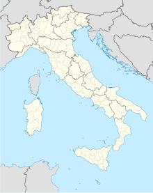
| Map | |||||||||||
 | |||||||||||
| Runways | |||||||||||
| |||||||||||
Palermo–Boccadifalco Airport (ICAO: LICP), also known as Giuseppe and Francesco Notarbartolo Airport, is the elder of two facilities which serve the Sicilian capital Palermo, in Italy. Located on the outskirts of the city, just before Monte Cuccio, it is one of the oldest airports in the country. Today it houses a Botanical garden and an ancient villa. The latter is used as the Officers' Club by the Italian Aeronautica Militare (Airforce).

History
The airport was built during the early 1920s and became the base of the Italian Regia Aeronautica with Palermo as the headquarters of the 4th Aerial Zone. After being seized by Allied forces during the Invasion of Sicily (Operation Husky) in July 1943, it was used by the United States Army Air Forces Twelfth Air Force as a combat airfield. The 52d Fighter Group flew Supermarine Spitfires from the airport from the end of July until December 1943. It was turned back over to Italian authorities after the Americans advanced north into Italy.
After the war, it was Palermo's main airport and the third busiest in Italy. 1960 saw the opening of Palermo International Airport 33 kilometres (21 mi) west of the city; it was also called Punta Raisi Airport. The original site was under joint military–civil use until 1 January 2009, when the Italian aviation authority ENAC acquired sole use of the airport.

Some wreckage from the 2005 crash of Tuninter Flight 1153 was stored at the airport.
Today the airport is used by one of the local Aeroclub and for general aviation. As of 2011 no commercial flights are operated from the airport.
Frequencies
- Boccadifalco (without flight control) 122.600 MHz
- Punta Raisi Monitor 119.050 MHz
- Palermo Radar 120.200 MHz
See also
- Falcone–Borsellino Palermo International Airport
- Vincenzo Florio Trapani–Birgi Airport
References
- "Aviazione Leggera on Line - modif. Arf 10/3/09". Archived from the original on 2011-07-22. Retrieved 2009-04-15. LICP on ulm.it
- Final Accident Report Archived 2011-07-21 at the Wayback Machine – ANSV.
External links
- Aeroclub di Palermo "Beppe Albanese"
- Accident history for at Aviation Safety Network
- Airport information for LICP at Great Circle Mapper.
- Current weather for LICP at NOAA/NWS