| Parakou Airport | |||||||||||
|---|---|---|---|---|---|---|---|---|---|---|---|
| Summary | |||||||||||
| Airport type | Public | ||||||||||
| Serves | Parakou | ||||||||||
| Location | |||||||||||
| Elevation AMSL | 1,289 ft / 393 m | ||||||||||
| Coordinates | 9°21′25.6″N 2°36′33.2″E / 9.357111°N 2.609222°E / 9.357111; 2.609222 (Parakou Airport (Parakou)) | ||||||||||
| Map | |||||||||||
 | |||||||||||
| Runways | |||||||||||
| |||||||||||
| Source: Landings.com | |||||||||||
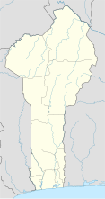
Parakou Airport (IATA: PKO, ICAO: DBBP) is a public use airport located 1 km northwest of Parakou, Borgou, Benin. It is to be replaced by the Tourou International Airport, a new airport in Tankaro, about 10 km northwest of Parakou, which will feature an asphalt runway 3,500 meters in length. The new airport entered service on 18 March 2016.
Airlines and destinations
| Airlines | Destinations |
|---|---|
| Benin Airlines | Cotonou |
References
- Airport record for Parakou Airport at Landings.com. Retrieved 2013-08-09
- "location of Parakou Airport" (Map). Google Maps. Retrieved 2013-08-09.
- "Bénin : l'Aéroport international de Tourou, l'autre éléphant blanc du régime Yayi ?". May 2018.
- "Bénin : Mise en service de l'aéroport international de Tourou".
- "Bénin Airline". benin-airline.com.
External links
- Airport record for Parakou Airport at Landings.com
| Airports in Benin | |
|---|---|
| Lists of airports | |
|---|---|
| By IATA code | |
| By ICAO code | |
| By continent | |
| Busiest airports | |
| Other lists | |
| Capital: Parakou | |
| Villages and suburbs |
|
| Notable landmarks | |
| Culture | |
| Transport | |
| Notable people | |
This article about an airport in Benin is a stub. You can help Misplaced Pages by expanding it. |