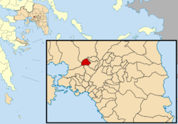
| Petroupoli Πετρούπολη | |
|---|---|
| Municipality | |
 | |
  | |
| Coordinates: 38°2′N 23°41′E / 38.033°N 23.683°E / 38.033; 23.683 | |
| Country | Greece |
| Administrative region | Attica |
| Regional unit | West Athens |
| Government | |
| • Mayor | Evangelos Simos (since 2023) |
| Area | |
| • Municipality | 6.597 km (2.547 sq mi) |
| Highest elevation | 262 m (860 ft) |
| Lowest elevation | 108 m (354 ft) |
| Population | |
| • Municipality | 60,146 |
| • Density | 9,100/km (24,000/sq mi) |
| Time zone | UTC+2 (EET) |
| • Summer (DST) | UTC+3 (EEST) |
| Postal code | 13231 |
| Area code(s) | 210 50 |
| Vehicle registration | ΙΖΧ |
| Website | www.petroupoli.gov.gr |
Petroupoli (Greek: Πετρούπολη, meaning "city of stone") is a semi-mountainous town in Attica, in the west suburbs of Athens. Petroupoli was part of the community of Nea Liosia until 1946, when it became a separate community. It was elevated to municipality status in 1972.
Geography
Petroupoli is situated in the eastern foothills of the Zacharitsa (Poikilo Oros) mountain, 7 km northwest of Athens. The municipality has an area of 6.597 km. Its main streets (25 March Ave., Anatolikis Romylias St. and Perikleous St.) connect the town with Ilion and Peristeri.
ASDA (Association for the Development of Western Athens) regards Petroupoli as the most developed town in the administrative sector of West Athens .
Culture and education
The Petra Festival takes place every summer. The area's junior football (soccer) team is named Akadimia Petroupolis
The traditional festival of the church in the upper town dedicated to the prophet Elias is usually organized around July in the playground of Profitis Elias where folk music and dances are performed along with other activities such as grilled meat selling.
Petroupoli incorporates a number of private and 15 public kindergartens, 12 primary schools (11 public and 1 private), 6 public lower secondary schools (gymnasia), 5 public upper secondary schools (lyceums) and one public Technical Secondary School (EPAL).
Historical population
| Year | Population |
|---|---|
| 1981 | 27,902 |
| 1991 | 38,278 |
| 2001 | 48,327 |
| 2011 | 58,979 |
| 2021 | 60,146 |
References
- Municipality of Petroupoli, Municipal elections – October 2023, Ministry of Interior
- "Αποτελέσματα Απογραφής Πληθυσμού - Κατοικιών 2021, Μόνιμος Πληθυσμός κατά οικισμό" [Results of the 2021 Population - Housing Census, Permanent population by settlement] (in Greek). Hellenic Statistical Authority. 29 March 2024.
- "EETAA local government changes". Retrieved 5 September 2021.
- "Population & housing census 2001 (incl. area and average elevation)" (PDF) (in Greek). National Statistical Service of Greece.
- "ΑΣΔΑ - Δήμος Πετρουπόλεως". Archived from the original on 2008-03-31. Retrieved 2008-06-17.
External links
- (in Greek) Municipality of Petroupoli
- (in Greek) News Blog City Guide of Petroupoli
- (in Greek) Facebook Community page
| Places adjacent to Petroupoli | ||||||||||||||||
|---|---|---|---|---|---|---|---|---|---|---|---|---|---|---|---|---|
| ||||||||||||||||
| Administrative divisions of the Attica Region | ||
|---|---|---|
| Regional unit of Central Athens |  | |
| Regional unit of North Athens | ||
| Regional unit of West Athens | ||
| Regional unit of South Athens | ||
| Regional unit of Piraeus | ||
| Regional unit of East Attica | ||
| Regional unit of West Attica | ||
| Regional unit of Islands | ||
| ||