| Porog Порог | |
|---|---|
| Selo | |
 War memorial (1941-1945). War memorial (1941-1945). | |
  | |
| Coordinates: 63°49′N 38°28′E / 63.817°N 38.467°E / 63.817; 38.467 | |
| Country | Russia |
| Region | Arkhangelsk Oblast |
| District | Onezhsky District |
| Time zone | UTC+3:00 |
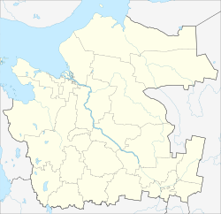
Porog (Russian: Порог) is a rural locality (a selo) and the administrative center of Porozhskoye Rural Settlement of Onezhsky District, Arkhangelsk Oblast, Russia. The population was 532 as of 2010. There are 9 streets.
Geography
Porog is located on the Onega River, 25 km southeast of Onega (the district's administrative centre) by road. Pavlovskaya is the nearest rural locality.
References
- Карта села Порог в Архангельской области
- "Всероссийская перепись населения 2010 года. Численность по муниципальным образованиям и населенным пунктам Архангельской области". Archived from the original on 2013-09-27. Retrieved 2019-02-13.
- Расстояние от Порога до Онеги
| Rural localities in Onezhsky District | |||
|---|---|---|---|
This Arkhangelsk Oblast location article is a stub. You can help Misplaced Pages by expanding it. |