| Privlaka | |
|---|---|
| Municipality | |
      | |
 | |
   | |
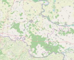
| Coordinates: 45°11′40″N 18°50′16″E / 45.194339°N 18.837753°E / 45.194339; 18.837753 | |
| Country | |
| Region | Syrmia (Spačva basin) |
| County | |
| Area | |
| • Municipality | 52.4 km (20.2 sq mi) |
| • Urban | 52.4 km (20.2 sq mi) |
| Population | |
| • Municipality | 2,192 |
| • Density | 42/km (110/sq mi) |
| • Urban | 2,192 |
| • Urban density | 42/km (110/sq mi) |
| Website | opcina-privlaka |
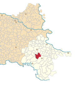
Privlaka (Hungarian: Perlaka, German: Wrevilack) is a village in Croatia. It located in eastern Slavonia region, 12 km south of the town of Vinkovci. In the 2001 census, there were 3,776 inhabitants, of which 98.68% Croats. The settlement gained the status of an municipality at the time when nearby Otok gained the status of town. Otok kept Komletinci as an suburb while Privlaka was granted separate independent local municipal government.
History
One Scordisci archaeological site in Privlaka dating back to late La Tène culture was excavated in the 1970s and 1980s as a part of rescue excavations in eastern Croatia. Archaeological site was a part of the settlement network of Scordisci in the area of Vinkovci.
In July 1943, during the World War II in Yugoslavia, Nazi forces destroyed agricultural machinery, including threshers, across several villages, including Privlaka.
References
- Register of spatial units of the State Geodetic Administration of the Republic of Croatia. Wikidata Q119585703.
- "Population by Age and Sex, by Settlements" (xlsx). Census of Population, Households and Dwellings in 2021. Zagreb: Croatian Bureau of Statistics. 2022.
- ^ Dizdar, Marko (2016). "Late La Tène Settlements in the Vinkovci Region (Eastern Slavonia, Croatia): Centres of Trade and Exchange" (PDF). Boii - Taurisci: Proceedings of the International Seminar, Oberleis-Klement, June 14th-15th, 2012. Austrian Academy of Sciences Press: 31–48. Retrieved 22 January 2019.
- Veljko Maksić; Nebojša Vidović (2022). Сведоци времена: историјски преглед развоја села Остеова [Witnesees of Time: Historical Review of the Development of the Ostrovo Village]. Vukovar: Joint Council of Municipalities. ISBN 978-953-8489-02-0.
External links
| Subdivisions of Vukovar-Syrmia County | ||
|---|---|---|
| Towns |  | |
| Municipalities | ||
| Villages of Vukovar-Syrmia County | ||
|---|---|---|
| Villages administered as part of cities |  | |
| Villages serving as municipal seat (other villages in municipality) | ||
This Vukovar-Syrmia County geography article is a stub. You can help Misplaced Pages by expanding it. |