| Puerto Navarino | |
|---|---|
 | |
| Coordinates: 54°55′32″S 68°19′26″W / 54.92556°S 68.32389°W / -54.92556; -68.32389 | |
| Region | Magallanes |
| Province | Antártica Chilena |
| Municipalidad | Cabo de Hornos |
| Comuna | Cabo de Hornos |
| Government | |
| • Type | Municipalidad |
| • Alcade | Hugo Henriquez Matus |
| Time zone | UTC−3 (CLST) |
| Area code | Country + town = 56 + ? |
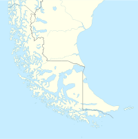
Puerto Navarino is a Chilean port on the Beagle Channel in western Navarino Island opposite Ushuaia in Argentina. Puerto Navarino is part of Cabo de Hornos commune. It is 54km west of Puerto Williams along a gravel road. It is one of the most southerly populated places in Chile.
References
- Burford, Tim (2005). Chile - The Bradt Travel Guide. Google Books. p. 680. Retrieved 17 November 2021.
{{cite book}}: CS1 maint: location missing publisher (link)
External links
- Comuna de Cabo de Hornos / Commune of Cabo de Hornos official website
- official website of Puerto Williams
54°55′32″S 68°19′26″W / 54.92556°S 68.32389°W / -54.92556; -68.32389
This Magallanes and Antártica Chilena Region location article is a stub. You can help Misplaced Pages by expanding it. |