| Puig de Fontlletera | |
|---|---|
 | |
| Highest point | |
| Elevation | 2,577 m (8,455 ft) |
| Geography | |
| Location | Catalonia, Spain |
| Parent range | Pyrenees |
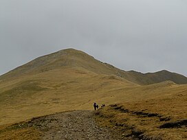
Puig de Fontlletera is a mountain of Catalonia, Spain. Located in the Pyrenees, it has an elevation of 2,577 metres above sea level.
See also
References
- "Mapa Topogràfic de Catalunya". Institut Cartogràfic de Catalunya. Retrieved May 22, 2010..
This article about a location in Catalonia is a stub. You can help Misplaced Pages by expanding it. |
42°22′36″N 2°14′09″E / 42.37667°N 2.23583°E / 42.37667; 2.23583
Categories: