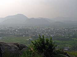
Town in Andhra Pradesh, India
| Puttur | |
|---|---|
| Town | |
 Puttur Town Puttur Town | |
 | |
| Coordinates: 13°27′N 79°33′E / 13.45°N 79.55°E / 13.45; 79.55 | |
| Country | India |
| State | Andhra Pradesh |
| District | Tirupati |
| Mandal | Puttur |
| Government | |
| • Type | Municipality |
| • Body | Puttur municipality |
| Area | |
| • Total | 43.29 km (16.71 sq mi) |
| Population | |
| • Total | 54,092 |
| • Density | 1,200/km (3,200/sq mi) |
| Languages | |
| • Official | Telugu |
| Time zone | UTC+5:30 (IST) |
| PIN | 517583 |
| Telephone code | +91–8577 |
| Vehicle registration | AP-03 |
Puttur is a town in Tirupati district of the Indian state of Andhra Pradesh. It is the mandal headquarters of Puttur mandal in Tirupati revenue division. It is known for a traditional method of splinting/bandaging bone fractures.
Geography
Puttur is located at 13°26′N 79°33′E / 13.43°N 79.55°E / 13.43; 79.55. It has an average elevation of 144 metres (472 feet). It is located 100 km from Chennai and 40 km from Tirupati city. It falls on the Mumbai- Chennai railway route. As it is located at the Andhra Pradesh and Tamil Nadu border, people speak Telugu and Tamil in this region.
Education
Puttur serves near by 6 major mandals. Puttur consists of 10 ZPHS government Schools, 12 MPPS schools, many private schools and many junior and degree colleges along with 3 major Engineering colleges under the School Education Department of the state.
See also
References
- "Municipalities, Municipal Corporations & UDAs" (PDF). Directorate of Town and Country Planning. Government of Andhra Pradesh. Archived from the original (PDF) on 28 January 2016. Retrieved 29 January 2016.
- "Census of India Search details". censusindia.gov.in. Retrieved 10 May 2015.
- "Tirupati District Mandals,it is situated between Tirupati and Chennai city" (PDF). Census of India. pp. 483, 515. Retrieved 19 June 2015.
- "District Census Handbook -Tirupati" (PDF). Census of India. pp. 22–23. Retrieved 20 January 2016.
- Panda, AshokKumar; Rout, Suvendu (2011). "Puttur kattu (bandage) - A traditional bone setting practice in south India". Journal of Ayurveda and Integrative Medicine. 2 (4): 174–178. doi:10.4103/0975-9476.90766. ISSN 0975-9476. PMC 3255447. PMID 22253506.
- Umashanker, K. (5 December 2018). "Despite advances in medicine, Puttur kattu has global takers". The Hindu. ISSN 0971-751X. Retrieved 30 December 2019.
- Manjunath, Amrutha (September 2017). "An Andhra Pradesh family's generations-old method of treating fractures". The Caravan. Retrieved 30 December 2019.
- "Puttur Pin Code, Puttur , Chittoor Map , Latitude and Longitude , Andhra Pradesh". www.indiamapia.com. Retrieved 25 March 2016.
- "School Education Department" (PDF). School Education Department, Government of Andhra Pradesh. Archived from the original (PDF) on 27 December 2015. Retrieved 7 November 2016.
- "The Department of School Education - Official AP State Government Portal | AP State Portal". www.ap.gov.in. Archived from the original on 7 November 2016. Retrieved 7 November 2016.
External links
 Media related to Puttur, Andhra Pradesh at Wikimedia Commons