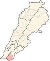
| Qalaouiyah قلويه | |
|---|---|
| Municipality | |
 | |
| Coordinates: 33°15′19″N 35°25′03″E / 33.25528°N 35.41750°E / 33.25528; 35.41750 | |
| Grid position | 189/295 PAL |
| Country | |
| Governorate | Nabatieh |
| District | Bint Jbeil |
| Elevation | 400 m (1,300 ft) |
| Time zone | UTC+2 (EET) |
| • Summer (DST) | UTC+3 (EEST) |
| Dialing code | +961 |
Qalaouiyah (Arabic: قلويه) is a municipality in the Bint Jbeil District in southern Lebanon.
Etymology
According to E. H. Palmer, the name Kalawei comes from the ancient Kelabo.
History
In 1881, the PEF's Survey of Western Palestine (SWP) described Burj Alawei as: “A village, built of stone, on high ground, containing 150 Metawileh, surrounded by olives, fig-trees, and arable land. The water supply is from cisterns only." They further noted: "Ancient remains and some lintels."
Demographics
In 2014 Muslims made up 99.41% of registered voters in Qalaouiyah. 98.22% of the voters were Shiite Muslims.
References
- Palmer, 1881, p. 23
- Conder and Kitchener, 1881, SWP I, p. 87
- Conder and Kitchener, 1881, SWP I, p. 116
- https://lub-anan.com/المحافظات/النبطية/بنت-جبيل/قلاويه/المذاهب/
Bibliography
- Conder, C.R.; Kitchener, H.H. (1881). The Survey of Western Palestine: Memoirs of the Topography, Orography, Hydrography, and Archaeology. Vol. 1. London: Committee of the Palestine Exploration Fund.
- Palmer, E.H. (1881). The Survey of Western Palestine: Arabic and English Name Lists Collected During the Survey by Lieutenants Conder and Kitchener, R. E. Transliterated and Explained by E.H. Palmer. Committee of the Palestine Exploration Fund.
External links
- Qalaouiyeh, Localiban
- Survey of Western Palestine, Map 2: IAA, Wikimedia commons
