| Vaghuhas Վաղուհաս | |
|---|---|
| Qozlu | |
 | |
  | |
| Coordinates: 40°06′52″N 46°28′47″E / 40.11444°N 46.47972°E / 40.11444; 46.47972 | |
| Country | |
| • District | Aghdara |
| Elevation | 988 m (3,241 ft) |
| Population | |
| • Total | 678 |
| Time zone | UTC+4 (AZT) |
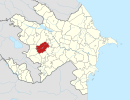
Vaghuhas (Armenian: Վաղուհաս) or Gozlu (Azerbaijani: Qozlu) is a village located in the Aghdara District of Azerbaijan, in the region of Nagorno-Karabakh. Until 2023 it was controlled by the breakaway Republic of Artsakh. The village had an ethnic Armenian-majority population until the exodus of the Armenian population of Nagorno-Karabakh following the 2023 Azerbaijani offensive in Nagorno-Karabakh.
History

During the Soviet period, the village was a part of the Mardakert District of the Nagorno-Karabakh Autonomous Oblast.
According to civilian reports, during the 2023 Azerbaijani offensive in Nagorno-Karabakh, Azerbaijani soldiers entered the village and forcibly demanded that its entire Armenian population leave while firing their weapons in the air.
Historical heritage sites
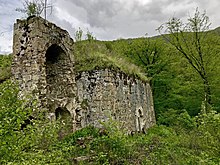
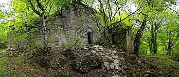
Historical heritage sites in and around the village include the ruins of the ancient Armenian settlement of Mayrakahag (Armenian: Մայրաքաղաք), including the Tiramayr Monastery (Armenian: Տիրամայր Վանք) built in 1183, an 8th/9th-century chapel, a 12th/13th-century cemetery, the monastery of Khatravank (Armenian: Խաթրավանք) built in 1204, the monastery of Karmiravan (Armenian: Կարմիրավան) built in 1224, also known as the Red Monastery – Karmir Vank, Կարմիր վանք, and the medieval village of Hin Vaghuhas (Armenian: Հին Վաղուհաս, lit. 'Old Vaghuhas').
Economy and culture
The population is mainly engaged in agriculture and animal husbandry. As of 2015, the village has a municipal building, a house of culture, a secondary school, seven shops, and a medical centre.
Demographics
The village had 638 inhabitants in 2005, and 678 inhabitants in 2015.
Gallery
-
 Scenery around Vaghuhas
-
 Forest near the village
-
A sign in Armenian reading "Vaghuhas"
-
 Khachkars of Khatravank
-
 Forest near the village
-
 Aerial view of Vaghuhas
-
 Interior of Khatravank
-
 The 13th-century Karmiravan Monastery
-
 Inscriptions in Armenian on the walls of the Karmiravan Monastery
References
- ^ Hakob Ghahramanyan. "Directory of socio-economic characteristics of NKR administrative-territorial units (2015)".
- Андрей Зубов. "Андрей Зубов. Карабах: Мир и Война". drugoivzgliad.com.
- Sauer, Pjotr (2 October 2023). "'It's a ghost town': UN arrives in Nagorno-Karabakh to find ethnic Armenians have fled". The Guardian. ISSN 0261-3077. Retrieved 9 November 2023.
- Hauer, Neil (September 29, 2023). "Tragedy in real time: The Armenian exodus from Nagorno-Karabakh". Canada: CTV News.
- Grigoryan, Rima; Makiyan, Hayk (September 27, 2023). "Stranded in Goris: Karabakh Family Sleeps in Van". Armenia: Hetq.
- Ш. Мкртчян / Майракахак или монастырь Тирамайр /Историко-архитектурные памятники Нагорно-Карабаха/ стр. 47-48 (360)
- "The Results of the 2005 Census of the Nagorno-Karabakh Republic" (PDF). National Statistic Service of the Republic of Artsakh.
External links
| Martakert Province | ||
|---|---|---|
| Capital: Martakert | ||
| Urban communities |  | |
| Rural communities |
| |
| Not under Artsakh control | ||
