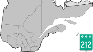
 Route 212 Route 212 | ||||
|---|---|---|---|---|
 | ||||
| Route information | ||||
| Maintained by Transports Québec | ||||
| Length | 63.2 km (39.3 mi) | |||
| Major junctions | ||||
| West end | ||||
| Major intersections | ||||
| East end | ||||
| Location | ||||
| Country | Canada | |||
| Province | Quebec | |||
| Highway system | ||||
| ||||
Route 212 is a two-lane east/west highway in the Estrie region in the province of Quebec, Canada. It begins in the city of Cookshire at a junction with Route 108 and runs through Newport, La Patrie and Notre-Dame-des-Bois before reaching its terminal at Route 161 in the village of Woburn.
Municipalities along Route 212

Major intersections
| This article contains a bulleted list or table of intersections which should be presented in a properly formatted junction table. Please consult this guideline for information on how to create one. Please improve this article if you can. (November 2021) |
| RCM or ET | Municipality | Km | Junction | Notes |
|---|---|---|---|---|
| Western terminus of Route 212 | ||||
| Le Haut-Saint-François | Cookshire-Eaton | 0.0 | 108 WEST: to Sherbrooke 108 EAST: to Bury | |
| La Patrie | 31.0 | 257 SOUTH: to Chartierville 257 NORTH: to Hampden & Scotstown | ||
| Le Granit | Saint-Augustin-de-Woburn | 63.2 | 161 SOUTH: to 161 NORTH: to Frontenac | |
| Eastern terminus of Route 212 | ||||
See also
References
- Ministère des transports, "Distances routières", page 81, Les Publications du Québec, 2005
External links
- Official Transport Quebec Road Map
- Route 212 in Google Maps
| Provincial Secondary Highways in Quebec (200-series) | |
|---|---|
This Quebec road, road transport or highway-related article is a stub. You can help Misplaced Pages by expanding it. |