| This article needs additional citations for verification. Please help improve this article by adding citations to reliable sources. Unsourced material may be challenged and removed. Find sources: "Rahachow" – news · newspapers · books · scholar · JSTOR (August 2023) (Learn how and when to remove this message) |
| Rahachow
Рагачоў (Belarusian) Рогачёв (Russian)Rogachev | |
|---|---|
| Town | |
 | |
 Flag Flag Coat of arms Coat of arms | |
 | |
| Coordinates: 53°6′N 30°3′E / 53.100°N 30.050°E / 53.100; 30.050 | |
| Country | Belarus |
| Region | Gomel Region |
| District | Rahachow District |
| Founded | 1142 |
| Area | |
| • Total | 18.06 km (6.97 sq mi) |
| Elevation | 136 m (446 ft) |
| Population | |
| • Total | 31,821 |
| • Density | 1,800/km (4,600/sq mi) |
| Time zone | UTC+3 (MSK) |
| Postal code | 247250 |
| Area code | +375 2339 |
| Licence plate | 3 |
| Website | Official website (in Russian) |
Rahachow or Rogachev (Belarusian: Рагачоў, romanized: Ragachow, IPA: [raɣaˈtʂou̯]; Russian: Рогачёв, romanized: Rogachjov; Polish: Rohaczów; Yiddish: ראגאטשאוו, IPA: [ragat͡ʃov]) is a town in Gomel Region, Belarus. It serves as the administrative center of Rahachow District. Rahachow is located between the Drut and Dnieper rivers. As of 2024, it has a population of 31,821.
History
The town is first mentioned in 1142 in Rus' chronicles. From the late thirteenth century it was part of the Grand Duchy of Lithuania, and then the Polish–Lithuanian Commonwealth. In 1772, the area was annexed by the Russian Empire.
On 16 July 1863 the local landowner Tomasz Hryniewicz was executed here by a Russian firing squad for leading the Rahachow detachment of Polish insurgents.
During World War II, Rahachow was occupied by the German Army from 2 July 1941 to 13 July 1941, and again from 14 August 1941 to 24 February 1944.
Rahachow also has a popular dairy product factory, whose products are supplied across Russia, Ukraine, and Belarus.
Notable people
- Joseph Rosen (1858–1936), rabbi
- Anatoli Lvovich Kaplan (1902–1980), artist
- Sergei Bautin (1967–2022), ice hockey player
Sights
- Church of St. Anthony of Padua
- Cathedral of Alexander Nevsky
- "Castle Hill" - a hill on which the castle of Queen Bona was located
- Monument to the founding of the city in the center of the "Castle Hill" with the inscription "From here the city of Rogachev went in the summer of 1142."
- Jewish Cemetery in Rahachow
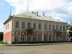
- The building of the former zemstvo council
- House of merchant Belenky
- Eco-Museum "Belarusian Lyalka"
- Museum of Popular Glory
- House of Uladzimir Karatkievich's grandfather
- Monument to condensed milk
- Rahachow booms
- Icon of the Mother of God with four hands
- Three family tombs - Greshnerov, Iolshinov, Verzheisky
- Memorial to the leader of the national liberation uprising of 1863 Tomas Grinevich
References
- ^ "Численность населения на 1 января 2024 г. и среднегодовая численность населения за 2023 год по Республике Беларусь в разрезе областей, районов, городов, поселков городского типа". belsat.gov.by. Archived from the original on 2 April 2024. Retrieved 9 April 2024.
- Dimnik, Martin (12 June 2003). The Dynasty of Chernigov, 1146–1246. Cambridge University Press. p. 25. ISBN 978-1-139-43684-7.
External links
| Districts (raions) |  | |
|---|---|---|
| Cities and towns | ||
This Belarus location article is a stub. You can help Misplaced Pages by expanding it. |