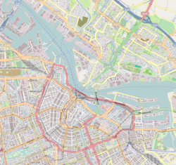
Neighbourhood of Amsterdam in North Holland, Netherlands
| Rapenburg | |
|---|---|
| Neighbourhood of Amsterdam | |
 | |
| Coordinates: 52°22′16″N 04°54′32″E / 52.37111°N 4.90889°E / 52.37111; 4.90889 | |
| Country | |
| Province | North Holland |
| Municipality | Amsterdam |
| Borough | Amsterdam-Centrum |
| Area | |
| • Total | 0.09 km (0.03 sq mi) |
| Elevation | 5 m (16 ft) |
| Population | |
| • Total | 990 |
| • Density | 11,000/km (28,000/sq mi) |
| Time zone | UTC+1 (CET) |
Rapenburg is a neighbourhood in Amsterdam, Netherlands. The main street is also called Rapenburg. Rapenburg is located in the centre of Amsterdam, on the northeastern side, close to the IJ. As of the year 2022, its population was 990.
Rapenburg was first built in the 1590s and was home to many shipmakers, due to its location near to the IJ and the River Amstel.
Galleries
-
 Rapenburg circa 1900
-
 Bridge in Rapenburg, 1911
-
 The West Indian Warehouse, built in 1642.
-
 View in 1972 from the IJ tunnel to the Waterlooplein.
References
- "Nieuwmarkt/Lastage (Municipal District, Netherlands) - Population Statistics, Charts, Map and Location". www.citypopulation.de. Retrieved 25 November 2023.
- Nijman, Jan (10 September 2020). Amsterdam's Canal District: Origins, Evolution, and Future Prospects. University of Toronto Press. p. 34. ISBN 978-1-4875-1079-4.
This North Holland location article is a stub. You can help Misplaced Pages by expanding it. |